Listen to the Land (Historical Geography) - Lesson 13
The Sharon Plain and Mt. Carmel
The rocks and roads will give you valuable information about the Sharon Plain and Mt. Carmel. The international road took different paths around Mt. Carmel depending on your final destination. The harbor and palace that Herod built in Caesarea were impressive.

The Sharon Plain and Mt. Carmel
I. Sharon Plain
A. Not many cities
B. Kurkar Ridges
II. The Plain of Dor
III. Mt. Carmel
IV. Caesarea
V. Jordan River Valley
- 0% Complete
The land influences the people that are living on it by affecting their stories. Learning to listen to the land helps you understand the details that are hiding in the background so that when you read the Bible, it’s like you see the narrative in living color and 3 dimensions.
0% Complete - 0% Complete
Major rivers in the Ancient Near East provided the resources necessary for empires like Egypt, Assyria, Babylon and Persia to grow and flourish. Israel is on a couple of the major trade routes that connects these cultures. The location of mountains, hills and valleys in Israel affects the lifestyle and travel patterns of the people who live there and the people travelling through.
0% Complete - 0% CompleteLearn how the geography and climate of the Cisjordan and Transjordan regions shape agricultural and shepherding activities, emphasizing the importance of rain patterns and water management techniques in biblical times.0% Complete
- 0% CompleteLearn how the granite, sandstone, and three types of limestone shape the lifestyle, agriculture, and building practices in the biblical lands, highlighting the geological factors that influence whether inhabitants are migratory or sedentary.0% Complete
- 0% Complete
Bashan is in the north and has enough rainfall and arable soil to support crops and large animals like cattle. The Dome of Gilead provides connection points for international and local travel. Ammon and Moab are neighbors and descendants of Lot’s daughters. Edom is south and are descendants of Esau.
0% Complete - 0% Complete
The people that migrated to live in the coastal plain were known as the Philistines. Because of the location and terrain, the roads were sources of international travel and trade. Cities were built for commerce and control. The Negev was an important area to control for travel.
0% Complete - 0% Complete
The Rift Valley is valuable because of its location and resources. Bitumen and Balsam were sought after. It was a popular trade route but it was important to know where to get water. Jericho was at crossroads and was near some major springs. Connecting events in biblical history to the event and location of the baptism of Jesus adds weight and significance to it.
0% Complete - 0% Complete
The hill country of Judah has enough rain to grow grapes and other crops. Hebron was first given to Caleb and then was the city that David ruled from when he first became king. It was a connecting point for local roads. Bethlehem and Tekoa are also cities in this area.
0% Complete - 0% Complete
Jerusalem is framed by the hills and valleys that are near it. The Sorek Wadi System is to the west and the Mount of Olives is to the east. David built a palace and Solomon later built a temple. Jerusalem was important in Jewish history and also has a place in eschatology.
0% Complete - 0% Complete
By the beginning of the first century, Jerusalem was the site of a magnificent Jewish temple built by Herod the great. He also built an impressive palace and a Roman fort which overlooked the temple. The events leading up to the crucifixion of Jesus take on added layers of meaning when you understand how the geography of the events reminded people of Messianic prophecies.
0% Complete - 0% Complete
Benjamin has the smallest tribal allotment but it is one of the most significant areas in the nation of Israel. The geographical features, the cities located there and the roads that run through it make it a region of national and international importance.
0% Complete - 0% Complete
The Shephelah is between the hill country and the coastal plain and has unique geographical features. When you know the location of the roads, valleys and cities in this area, you can see their significance in the stories. When you understand where Micah and Isaiah came from and their historical context, you can understand why there is a difference in their message and tone.
0% Complete - 0% Complete
The rocks and roads will give you valuable information about the Sharon Plain and Mt. Carmel. The international road took different paths around Mt. Carmel depending on your final destination. The harbor and palace that Herod built in Caesarea were impressive.
0% Complete - 0% Complete
The hill country of Joseph has abundant resources and nearby roads for commerce. Shiloh was a religious center and the place where Joshua met with representatives from each tribe to determine their tribal allotment. The women of Shiloh also were instrumental in saving the tribe of Benjamin. Shechem was important as far back as Abraham. Every time people would see Mt. Gerizim and Mt. Ebal, it was a reminder of the blessings and curses of their covenant with God.
0% Complete - 0% Complete
Who was Omri, and why was he significant in making Samaria an important city? When the people of Judah returned from Persia, there was a conflict with the people of Samaria. The animosity that was still present during the ministry of Jesus set the stage for an encounter he had with a woman that was at a well near the city.
0% Complete - 0% Complete
Upper and Lower Galilee have the climate soil that is conducive to widespread agriculture. Lower Galilee also has some valleys that became major roads. Major empires of the fertile crescent exerted their influence here as they expanded. When the Greeks took control with their military, they also spread their cultural influence.
0% Complete - 0% Complete
The Jezreel Valley is the center of activity for many of the biblical narratives. Not only was it an important economic and strategic location for Israel, but also for the Canaanites, Egyptians, Arameans and Assyrians. It is also a place where significant events took place in the lives of the prophets and Jesus.
0% Complete - 0% Complete
This body of water is often referred to as a, “sea” even though it is fresh water, not salt water. There are not many stories in the Hebrew Bible that take place in this area, but it is a center of activity for Jesus during his ministry. Many of the parables are illustrations taken from local culture and geography.
0% Complete - 0% Complete
The Huleh basin has an abundance of water from several sources. The soil is also good, but the conditions for growing crops in some areas presents some challenges. Dan is a strategic city in the north as a gateway to the region and a religious center under Jeroboam. Caesarea Phillippi was built by Herod and was a place that Jesus used to teach his disciples about his role as Messiah and their future as leaders of the church.
0% Complete - 0% Complete
The Gospel of Luke traces the journey of Jesus to Jerusalem, and the book of Acts traces the journey of the gospel going out from Jerusalem. The events in Pentecost have a connection to the events at Mt. Sinai. The gospel is for the world but the events that made it possible are anchored in Israel. (Don't forget the Epilogue, Lesson 21!)
0% Complete - 0% Complete
There are two different stories in the Gospels of Jesus feeding large groups of people. One account is in John 6 and another account is in Mark 8. The message is similar but the geography gives you some clues to help you understand why the details are different.
0% Complete
Have you ever read about a place and when you went there in person, it came alive? As you walk through the hills and valleys of Israel with Dr. Parker, you will see the stories of the Bible in living color.
Your location affects your lifestyle, relationships, worldview, occupation, diet and travel. In ancient Israel, you depended on the resources around you to survive. People often lived near springs or rivers, but it was possible in some places to collect rain water and ration it through the year. The terrain and the type of soil would determine what crops you could grow, or what animals you could raise. Living near a road would give you opportunities to sell what you produced or buy what you needed. Your location would determine the amount of risk you would face from people in neighboring countries. By living in the hill country, you would develop a different mindset than if you lived on an open plain.
Once you begin to have an understanding of the, "rocks and roads" of Israel, reading your Bible with a good map next to you will help you get a 3 dimensional perspective. When the characters and the scenery become life-like in your mind, you will find yourself being inspired and motivated in your understanding of your relationship with God and how you can apply it in your interactions with others. Take this opportunity to learn from Dr. Parker to "Listen to the Land!"
Recommended Reading:
Encountering Jesus in the Real World of the Gospels, by Dr. Cyndi Parker
Holman Illustrated Guide to Biblical Geography, by Paul Wright
Satellite Bible Atlas: Historical Geography of the Bible
Recommended Books
Listen to the Land: Historical Geography - Bible Study
Have you ever read about a place and when you went there in person, it came alive? As you walk through the hills and valleys of Israel with Dr. Parker, you will see the...
Satellite Bible Atlas
A comprehensive guide to biblical geography, The Satellite Bible Atlas by William Schlegel provides historical context and insightful maps to help readers better understand the world of the Bible.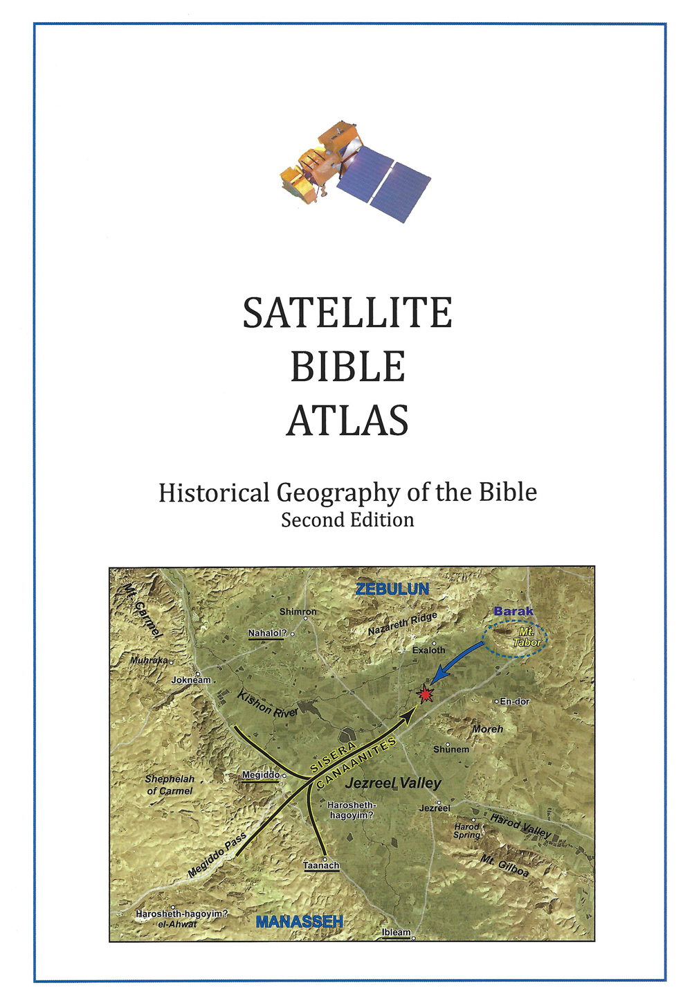
Links
Downloads
Dr. Cyndi Parker
Listen to the Land (Historical Geography)
bs600-13
The Sharon Plain and Mt. Carmel
Lesson Transcript
Dr. Cyndi Parker [00:00:12] All right. We are finally making our way out of the southern arena. We've been hanging out there for a long time, looking at connections to Egypt, looking at connections to Edam, the Shailagh, the coastal plain. All those really good things. Before we move on, we are we're moving up an arena, so we're going right into the middle to the heartland of Israelite country. Before we do, let's do a quick review. Again, this would be my if I were testing you, so you can always pretend that you're going to be tested and maybe you can just test yourself and see if you recognize if you're getting to know the maps. Let's actually start in the Transjordan. So we have the area up here to the north. I don't have it colored in, but hopefully you know the name Bishan. You're like, Oh yeah, we know this plateau. If we had a color, it would be red for all of the basalt that was laid down on top of the limestone. We move down and we get this big dome of Gilad with the lower Gilad and upper Gilad with Amman kind of nestled into the back of that dome. And then we get the mixture, the plateau. This is also known in as is MOAB further down. And then the one that is off the map down here is Edam. And then if you move into the area that we just came out of our southern arena, we have the Philistine Coastal Plain over here, we have the biblical Negev. We walked her way up this Rift Valley or the Arava, and we took a glance at how there's a lot of synonyms in that is mostly visible. And then we saw the sento manian of the hill country and then we just talked about the Eocene of the shayla. So now we're going to move a little bit to the north and we're going to look at the area that is in this green oval. So it's not exactly it's a little bit tilted off the side. We're moving into the house of Joseph. So the house of Joseph is how it was called. It was called that in the biblical text. We could also say this is the tribal area of Ephraim and Manasa or half the tribe of Manassa. These are the house of Joseph because Ephraim and Manassa were the sons of Joseph and something we probably don't talk about nearly as much as we should. They are the sons of an Egyptian or a black woman who had married Joseph. We just don't always talk about that. We kind of we think of these matriarchs as being like Sarah and Rebecca. But we also have Orson Nath, who is the wife of Joseph, the mother to Ephraim and Manassa. And so now we're going to look at their territories. They were quite a large house. They were quite a dominant house. When you think of the Israelite tribes, they were some of the largest of the tribes, most powerful the tribes. And the earliest of Israelite history in the land is very Ephraim and Manassas centric. So it'll be interesting area for us to look at. We're going to start over on the West. So if we were to define on our map where we are, we're at the Yukon River. And so we're seeing how the Philistine Coastal Plain, we're accustomed now to seeing the two different branches of this international coastal highway. And because of the Yukon River, here it comes from, there's a spring, here it afek and it flows out towards the Mediterranean Sea. This creates the barrier that makes international travel really quite difficult and it is the air con that pushes everything to the higher ground. So the Inland International Road is going to be right as the center manian of the hills is dumping down onto the coastal plain. Once we get into this central arena, we don't have a CHAVELA, so we really just have hill country with snow manian coming, stopping and the flatness of the coastal plain. Once we end up in this territory, we also don't have the send the snow knee and rock of the Judean wilderness. It's wilderness because it's to the east. And so the watershed ridge is preventing water. But we pretty much have sent Manian all the way over. This is going to change the lifestyle of everyone who lives here. Okay. So if we are focusing primarily on the coast, we're going to say the Sharon plane is from the Yukon River all the way north off this portion of the map. We're going to look at Mount Carmel. So from Mount Carmel, which pokes its way into the Mediterranean Sea and creates the only texture to the. Coastline. It's Mount Carmel all the way down to the Yukon. The majority of this plain coastal plain area, we call it the Sharon Plain. You may notice on the map how there aren't very many cities that are dotted. It's way up there. And this is for a very, very particular reason. It was mostly swampy most of the biblical time until we get to our very good friend, Herod the Great. So until this time, this is why we don't have I mean, Herzliya, this is a modern day town, Netanya, modern day town. So the towns that are actually listed, it's anachronistic to the time period we're talking about. So this was like scrub brush, things that are just growing wild. It's not really a place conducive to travel, which is why the international road has to move over. Now, we could say, why is it that we have so much swampy land? Why is it that no one is able to live on the Sharon Plain like the Philistine Coastal Plain? And I would say most of that is due to what not just me, what are called the Kirk Carr ridges. We saw the sand dunes that was further to the south, the Philistine. We even saw pictures of the sand dunes, modern day these sand dunes. Over time, as more and more pressure was put on them, they solidify into a stone or into a hard substance. There are three ridges of them and they run parallel to the Mediterranean Sea, so they run all the way along the coastline. But they're most problematic up here, and you can see them quite visibly and demonstrably on the horizon line. If you look at a geological map, it's even more distinct. So they just run really close to the water and then they run parallel. And then our third one is not quite so distinct as the first two, but because they create bumps on the surface of the ground, it means that they're preventing water from draining through the Sharon plane. So we have all of this water that is running off of the hills. We have alluvial soil that is coming down and collecting in the basin. We would think and anticipate it would be a massively wonderful place to control, but all of the water comes down here and then it gets stuck and it just sits there and everything turns into a swampy mess. Modern day, of course, even in ancient times. By the time we get to the first century by Herod the Great, they were able to drain the Sharon plane. And then once we drain it, we get what is called mystery in red sand. It actually has a really interesting color, very orange color. A lot of it is the terra rosa coming off of the hill country. It's mixing with the sands like sand dunes. It's very mineral rich. And now that the Sharon plane has been drained in modern day, this area is known for producing a lot of the citrus in Israel. So if you're in Israel and they're like the citrus, the the grapefruit and the oranges and all of this is anachronistic to the biblical times. But this place is known for creating some of the best and most delicious fruit, and it's coming out of this sand. So let me show you a little bit what Kirchner looks like. It looks like sand. It really does. You can see how it's all been layered, like pressed, compressed, and then it's solidified. Almost petrified is what it looks like. You can when you get up really close, it feels gritty, like you can actually feel the sandy texture to it. So Kirchner is hard enough that like the NARI crest we saw down with Eocene, you can cut this and you can build with it. And so I'll show you another picture here. We have like a big block of Kirchner and then over here we can see how some Kirchner has been cut and is being used as stone to layer like one course of stone upon another. So it becomes a really great material to use if you know how to use it. In the Hebrew Bible times, it wasn't used there for the swamp of the Sharon plane. In the New Testament Times, it was started to be used as a natural commodity a little bit more. Okay. So just a little bit further north of the Sharon plane, because of Mount Carmel pushing out towards the Mediterranean, it pushes the plane and creates a very narrow passageway. The primary city, the only real city that is dramatic, is mentioned in the Bible is door. So we call this the plain of door because it seems to all belong to door. Now, why is it that I don't draw the international road to go up this portion of the plane? Well, some of it is because it deals with the same issues that the Sharon plane does. The cur car continues to run north. So and with such a narrow plane, it's still kind of swampy in some areas. Plus, you have this really difficult, narrow passageway to get around the nose of Mount Carmel. So people tended to avoid the plain of door. Now that just opens and begs all kinds of other questions because because of the Mount Carmel range, where's the international road going to go? We have a great big, huge mass of stone that is in front of us and is blocking our way. It's so we would assume that it's creating an obstacle that will prevent international travel. Well, this is when we get to talk about rocks again, rocks and roads as it all goes back to rocks and roads. Okay. The very western part of the Mount Carmel Ridge is made out of cinnamon in this. I love this little portion of Mount Carmel, too. It's it's quite distinct on the horizon line. It has its Mount Carmel is quite high. We're looking at about 47, 4500 feet. So it's quite high. And then it drops very dramatically and then the coastline swings in behind it. In our ancient writings, as Egyptians were were exploring land and as they were trading, the Egyptians sailors used to talk about how you could anchor your boats on the other side of the antelopes nose. So they they thought that this Mount Carmel Ridge poking out and then dropping significantly into the water was looks like an antelope snows. So this is all sentiment. And so we would, as we would expect with all Panamanian Terra Rossa were already north and were west and were high in elevation, which means this is a very fertile area. All through ancient times, all of the Canaanites used to look towards the highest peaks of Mount Carmel and associate these high places on the hills as being the places where the gods resided. So Mount Carmel had this like mystical, God like association. This is the place where heavens and earth come together on Mount Carmel. Okay, so that's an Armenian. As we move down at a diagonal in a southeasterly direction, we hit another section of Mount Carmel and it is actually Eocene. So Eocene like we saw down in Australia. And in fact, this is called the Chavela, the lowlands of Carmel. So we think of the Shaler always as the Judean Falla that is the most popular because there's so many biblical stories that are happening in that region. But we do also have a fella here where the height of the mountain is really high here, and it drops dramatically by a couple thousand feet down onto the fella here. Now we would say, Well, I'll continue on and then we'll fill in the gaps. Right after the Eocene fella, we pick up another little block of Santo Manian. Now, what about the ridges in between? Just like this fella we saw where you seen and seen hominy and meat. There's often a little ridge, a little valley there where the snow nian is visible and snow nien takes on the shape of whatever rock is below it. And so just like the diagonal road through this fella, we are also are going to find here on Mount Carmel where in the gaps between. The Eocene and the cinnamon in. We get these layers of snow, neon, and up here the snowy and chalk just creates really wonderful chalky moats, which then is going to aid in our passage way through Mount Carmel. You're not going to choose to go up and over the cinnamon in the Eocene wouldn't be so bad. But if you have a nice warren out easy trough, that's what you're going to choose to go through. And sure enough, if we look at our international routes, there are three passageways through Mount Carmel. You could say, okay, so which one do you choose? You're coming up from Egypt. How do you make a strategic choice? Well, you go based on where your destination is. So if you're going to go in order to make use of the Mediterranean Sea, you're going to take the far western pass. And it has a city at its head called Yolk Neon. And so we call this the Ukrainian pass. As soon as you get through the pass, you travel right along the floor, the base of Mount Carmel, into the plain of Asher and up to the plain of or up to the city of Akko. You could if you're going to Aram Damascus. So you are continuing to go north. Then you would take the middle pass, which has a very dominant city on the other side of the past called Megiddo. And this would be the Megiddo Pass. This was the thinnest, the narrowest of our passages, but probably the most popular because of its destination point. And then you would cross the Jezreel Valley and go to the Sea of Galilee and then head north and then ultimately hang a right and go to Aram Damascus. But what if you want to go to Gilead? And this is the story that we saw when we were looking at Joseph being picked up by the caravan from Gilead going to Egypt. They would take what we called the Dotan pass. So you break off from the international road. So a little bit earlier, you go through this really small. It's very narrow. It's kind of a wide open pass. You hit a very nice wide valley. Easy travel. You pass it blame here. And then you're basically in the Jezreel Valley. You have the Harrowed Valley, and this is our famous and viable East-West connection point. And then it's really easy. It just basically shoots you directly over. This is Lower Gilead. So the place where Gilead has is lower in elevation. It's easier to ascend into the hills. So this is our great connection. We're going to keep our eyes on all of these passageways because we know any city that is going to guard such enviable and valuable passages through a barrier like Mount Carmel has to be significant. But before we get there, we're going to save that a little bit. Let's go to a very famous city. So now so we can see we have the Sharon plane, the plane of door up here. Right here is our Mount Carmel Ridge. This was empty basically all throughout the Hebrew Bible time and empty all the way up until our friend Herod the Great decided to come. And he was given the kingship of this land. And he thought, you know, there's other people around who exist, people like Cleopatra, my great nemesis, you know, down in the earlier times. And he goes, I don't have a good port city. Yeah, there's acoba is kind of weak. He has massive Rome envy and knows all the wealth is coming out of Rome. Right. Everything Herod does, it is in ante anticipation of looking towards in adoration of anything Rome is doing. He needs a port, but there's problems, Kirk carriages. There's no fresh water here. There's like there's nothing here. There has never been anything here. But there's a bonus for Herod because this land does not have buried Israelite memory. It's virgin territory. So there's no. He's not bothering the Jews by building something there. They're not going to say, Oh, but our forefathers, because there was nothing there before. So this is actually really great territory for him. And so Herod does something really remarkable. He his engineers figure out a brand new way to build underwater where they get, like, wooden frames and then they learned how to make something of a cement mixture. But they learned that if you mix in volcanic ash to this cement mixture, it will solidify when it's under the water. And so they take these wooden frames, float them out into the Mediterranean Sea, fill it with this mixture. It gets heavy, it sinks. And then you take the wooden frame when it solidifies, take the wooden frame off, float it back up to the top and build layer upon layer upon layer, very patiently creating one of the largest harbors of the ancient world. It rivaled the harbor of Athens, which is known as being this great and powerful mighty harbor. And Herod goes, You know, I kind of want that all to myself. So he builds this huge hook out into the Mediterranean. It had a lighthouse on the end. It was open for traffic coming this way. And then he built these huge storehouses for grain, for olive oil that was all heading out towards Rome. And he, of course, then because there's no water anywhere to be found, has to build an aqueduct and go up here to the center, Armenian rock of Mount Carmel, and through the aqueduct, bring the aqueduct to Zechariah to support the city of Zechariah. It's mind boggling is it's so impressive. And then what does it do to this trade? People no longer have to go through Mount Carmel. Herod bends the trade into himself, and now everything goes this way into Zechariah Zechariah Maritime and out to the Roman Empire for the Roman Empire to Zechariah and into his pocket. So this was a powerful, very strategic city for him to build. Let's take a look at some of the impressive things that he did. It's so easy to show pictures of Caesar, of Herod's architecture. This is the aqueduct that he built. You can see the Mediterranean Sea in the background. This aqueduct had to be continually refurbished because there's shifting sand underneath and it kept ruining the incline or the decline of the aqueduct to keep the water flowing. But this connects all the way up to Mount Carmel, and then it's broken here. But it would have continued all the way down into the city. Or we could go and just be super impressed with the city that he built. So there's one place you can stand. We are looking to the North Mediterranean Sea on the west. If I were standing just a tiny bit higher, I'd be able to catch the glimpse of the high peak of Mount Carmel, just beyond the ruins here. Herod's palace was off to the side over here. The areas with the columns would be the place where he would like. People would bring their grievances. This would be the very public area of the palace. It is also the area when Paul is taken into custody and Paul is put on a ship, the last ship leaving towards Rome, and it is filled with all the goods of Judea getting ready to go. The very last ship of the season out towards Rome. And Paul was kept in prison for a long period of time. It would have been in one of the rooms surrounding in this area, around this courtyard, which is is interesting, to be able to go and stand here and imagine the sounds of the city, the smell of the salty air, the the shouting of the sailors. And it's so easy to just imagine yourself in that position of Paul. We have a nice big Hippodrome that is here. A lot of this site has been eaten away because of the the fury of the ocean during the rainy season. It can get quite stormy, deep and a lot of the remains that are here. But we have a Hippodrome that Herod built. We have a theater that is just behind us. And this is the harbor. This is one third the size of Herod the Great's harbor. Like what we have left. If you look at a good aerial view of Zechariah, you can still see the foundations of Herod's harbor as they stick out into the sea and they swoop around to the north. Or if you're adventurous and you go and you want to do some scuba diving, you can still scuba dove and see the foundation of Herod's harbor. Let's go visit Herod's Palace, though. Let's walk beyond where prisoners are being kept. And let's look at the private residence of Herod. This is obviously the foundation. And I love this because he built his palace on a rock ledge that pokes its way into the Mediterranean Sea. If you put yourself on a boat on the horizon line coming from Rome to Zechariah, the effect of that would have been like his palace was floating on water because it wasn't even with the rest of the coastline. J You know, everything he does is for effect. Well, you have to appreciate that this would have been two floors. We assume it was two floors. We're only looking at the foundations of the first floor and there's a big rectangle that is right in the middle. Hopefully you see that rectangle. Guess what that was? That was a swimming pool. His own private swimming pool. Now we're kind of like, okay, maybe he just brought water from the Mediterranean in here. Oh, no, no, no. This is a freshwater swimming pool in a place that has no source of fresh. This water has to come from the aqueduct, which is coming from Mount Carmel, surrounded by the salty Mediterranean Sea. Like, again, everything he does is absolutely fantastic. You can see the texture of the rock, and we're looking at the Kircher again. We have a few mosaics that are left from this time period. All the building stones in this area are all Kircher. We do because it is the Mediterranean Sea. During the rainy season, the storms that come from the Mediterranean come crashing in and it can be quite startling or fun and adventurous depending on what mood you're actually in. Okay. So that is our sharing plane and the plain of door introduction to some of those things. The significance of Sensorium Maritime given to it by Herod. Now let's move. Still in the middle arena, but I'm going to take us over to the Rift Valley and then we're going to save the main hill country area. We're going to save that for later. So we're going to go we just went on the western side of the central arena. Now we're going to the eastern side of the central arena. So the Jordan River Valley. The Jordan River Valley then is going to have a different name than the river. It's different. The river, the Rift Valley was dry. So we had from the Dead Sea area all the way down to a lot. That is biblically what is called the river. When we're talking about the region that goes between the Sea of Galilee to the north and the Dead Sea to the south, now we're in the Jordan River Valley because the Jordan River comes out of the south end of the Sea of Galilee and it drains into the Dead Sea. So I'm going to call this the Jordan River Valley, and I'm driving in our road. I'm putting it in this yellow color because just to remind us, this road is not as significant as this road. The international road is still where the high value money is. But this is a significant road because when we go back to our Trans Jordan lessons, we know this western side of the Transjordan is the wettest side and all this soil and all the water is going to drain here. So this is like the breadbasket of this area. So this eastern side of the Jordan River is quite lush with agriculture. This is where the roads would have gone. Okay. So if we're looking at that and I already mentioned that we no longer have the effects of the snow knee and rock draped on top of the snow. MANEA We just have snow Armenian from one side all the way to the other, but it is dry still. So as we work our way into the central arena, we're still seeing the texture of the hills. We still get sharp valleys that are in the hills. We just don't have so much agriculture that is here. And notice no one has bothered terracing these hillsides because there's not enough rain. It wouldn't matter if they terraced them or not. So you can sit here looking down and these students in this picture are all looking down into the Rift Valley. As we come down off of the cinnamon and rock into this Jordan River basin, we're starting to see that there's different layers here of the Jordan River Basin, this flat part of the Rift Valley, there's different textures. So look how we have all of these trees that are here. And then from the trees we have this kind of marley sand. They're not really sand dunes, but and it's not really sand known in either, but it's kind of chalky. It's not usable areas. So where we have the wetness of the Jordan River, then we get this brush that grows up. So something like this, we're just beyond we get this kind of gnarly looking land. But right, you can tell where the river goes because of the heavy brush that is here. This is the place. Although it is much smaller today, it would have been much whiter in ancient times. And it's smaller because Israel and Jordan are both taking water out of the Jordan River to use for agriculture. So we just the Jordan River is just much smaller these days than it ever used to be. And in draining the river valley, it is changing the way that animals and wildlife make use of the river valley. So where the bears used to come down from the area of like modern day turkey and lions used to come up from ancient Egypt, this no longer is a good highway for those animals. It's too narrow and it's too rugged, and it doesn't provide the same kind of security that it used to. But we can still see at least the effects of what this area used to look like. And then if we were to take a look at the Jordan River itself so you can see again the wetness of the reeds on either side, the Jordan River, which is perpetually and always a little bit on the muddy side, which is interesting because we do have in the Jordan River Valley, we have a story of someone from Aram Damascus who came down to meet up with Elisha, this guy who had leprosy Neiman and he comes down in Asia, tells him, just go to the Jordan and dip seven times and my God will heal you. And he goes and he sees the river and he goes, Maybe not, you know, and everyone tends to have this kind of look on. They're like, Hmm, I don't think so. And especially in Aram Damascus, there are two rivers and they're clean and pure at all times. The Jordan is always just a little bit muddy. You know, wouldn't you just leave it to the servants who understand the wisdom of why don't you just try anyway? And he does. And he becomes clean. But it's when you see the Jordan that you understand why he would have reacted in such a way. We talked when we were doing our Transjordan section, we talked about these connecting points and I would say primarily the Rift Valley in this Jordan River Valley area. This is the part of the Rift Valley that is creating the most connections for the ancient people who lived on this land. So between the Dome of Gilead and the House of Joseph on this side, we've already talked in detail about Jericho. I want us to look at this little tiny crossing that is here, but we're going to take a look and see if you see where the pointy arrow is. You can pick out this green valley. We can actually match the rock on one side of the valley to the other. So it's a big like fissure when the rock was just pulled apart. You can see the matching strata on either sides, but it creates this nice. It's not super wide, but it's wide enough to encourage travel and it goes straight up into the heartland of the house of Joseph. And then over on the other side, if you go north just a little bit, we hit the jab like, remember, the Jarvik is the one that divides the Dome of Gilead in half. And then we get to Pella panel or Sioux Coat that are all the ancient cities that are right here at the mouth of the Geopark. We could go a little bit further to the north. And if I add the the road that goes along the spine of the hill country where it ends, it concludes it doesn't go any further than this, than the Jezreel Valley up in here. It ends at a really important city called Beit Shan, which is right off the map. And Beit Shan. This connecting point here is what is our Jezreel Valley, the road valley, right past Beit Shon, and into the Dome of Gilead. Okay. So as we're looking at these connections. Let's do this one in particular where the green lines are as we're thinking of moving into the hills. But we haven't gone up there just yet to explore. Okay. Adam is one of our crossing points of the Jordan River, and we see this natural connection up here to the Jarvik, the natural connection to the Far Valley, and then it makes a zig zag. And once you get to Shek, come here, we have this nice other y it's not. So again, they're not huge, huge valleys. It's not Jezreel Valley quality, but it is wide enough that if you go, you know, if I have to negotiate going west somewhere in these hills, I'm going to take the valley that is wide enough for several different donkeys to ride next to each other as you head out towards the coast. So already we should be thinking this House of Joseph territory is quite different than the House of Judah that is centralized around Jerusalem. Jerusalem was blocked off and barricaded or protected depending on who's coming at you or if you're trying to get out. But once you get up to the House of Joseph, they actually have a decent number of ways to come in and out of the land. You can go north to be shorn out and over. You can go down the far a valley. You can head out to the coast. If you go down the far valley, you have this nice easy passageway over the Jordan River and then you're in the Transjordan before you know it. So this should already set us up for the strength of the House of Joseph being different from the tribal areas of Judah and Benjamin to the south. Okay. A couple of pictures and we saw this one when we were looking at the Transjordan. So this is the one I take from the Transjordan side, from the mouth of the Jarvik. We're looking across the lushness of the eastern side of the Jordan River Valley. And we're looking at right here is the path of the Far Valley as it pushes its way up into the hills. And then these are the hills of Samaria or the hills that belong to the house of Joseph. So this is this would be maybe this will help. If we were to travel, this is exactly how we'd go. If we spin our heads a little bit and we look to the north, then we're going to look right up the Rift Valley. And you can see how there's still an incline to the land. Right. Because everything the Jordan River is going to flow downhill past us and down to the Dead Sea. So these are the hills over here of the Transjordan, and these would be the hills. We're starting to see the very last bit of the hills of the house of Joseph. And again, we're looking at just how lush and full of agriculture this part of the Rift Valley is. If we were to continue going all the way north, we're just beyond where this picture shows. We would end up at the Sea of Galilee. Okay. So we've looked at what this kind of western portion of the House of Joseph looks like with the coastal plain, the Kirk car ridges. And we've looked at the land of the Rift Jordan River Valley area so one is kind of Mediterranean Sea facing, the other one is just north south Rift Valley facing. We've looked at how different those are, but how they kind of feed into the hills of the house of Joseph. So before we really go up into that hill country, let's just pause and see if anyone has any questions.
Speaker 2 [00:37:01] Did Herod have to negotiate with the Philistines to build Syria?
Dr. Parker [00:37:06] Good question. Were there Philistines in existence by the time of Herod the Great? That is an even more complicated question. We don't have great historical records of the demise of the Philistines. What we have is the onslaught of the Assyrians, the coming of the Babylonians, Alexander the Great, bringing the Kingdom of Greece in and through this transition of power. Other people are using the big, significant cities of the Philistines, and we lose the historical record of what happened to the Philistines. So by the time we get to Herod the Great. We do have other people groups and we we have the Jews who are there. We have the Samaritans that are there, the Iranians that are there. But we no longer have record of the Philistines being there.