Listen to the Land (Historical Geography) - Lesson 12
The Shephelah
The Shephelah is between the hill country and the coastal plain and has unique geographical features. When you know the location of the roads, valleys and cities in this area, you can see their significance in the stories. When you understand where Micah and Isaiah came from and their historical context, you can understand why there is a difference in their message and tone.

The Shephelah
I. Geological Features
II. Roads
III. Valleys
A. Aijalon
B. Elah
IV. City Lists
V. Prophets
A. Micah
B. Isaiah
- 0% Complete
The land influences the people that are living on it by affecting their stories. Learning to listen to the land helps you understand the details that are hiding in the background so that when you read the Bible, it’s like you see the narrative in living color and 3 dimensions.
0% Complete - 0% Complete
Major rivers in the Ancient Near East provided the resources necessary for empires like Egypt, Assyria, Babylon and Persia to grow and flourish. Israel is on a couple of the major trade routes that connects these cultures. The location of mountains, hills and valleys in Israel affects the lifestyle and travel patterns of the people who live there and the people travelling through.
0% Complete - 0% CompleteLearn how the geography and climate of the Cisjordan and Transjordan regions shape agricultural and shepherding activities, emphasizing the importance of rain patterns and water management techniques in biblical times.0% Complete
- 0% CompleteLearn how the granite, sandstone, and three types of limestone shape the lifestyle, agriculture, and building practices in the biblical lands, highlighting the geological factors that influence whether inhabitants are migratory or sedentary.0% Complete
- 0% Complete
Bashan is in the north and has enough rainfall and arable soil to support crops and large animals like cattle. The Dome of Gilead provides connection points for international and local travel. Ammon and Moab are neighbors and descendants of Lot’s daughters. Edom is south and are descendants of Esau.
0% Complete - 0% Complete
The people that migrated to live in the coastal plain were known as the Philistines. Because of the location and terrain, the roads were sources of international travel and trade. Cities were built for commerce and control. The Negev was an important area to control for travel.
0% Complete - 0% Complete
The Rift Valley is valuable because of its location and resources. Bitumen and Balsam were sought after. It was a popular trade route but it was important to know where to get water. Jericho was at crossroads and was near some major springs. Connecting events in biblical history to the event and location of the baptism of Jesus adds weight and significance to it.
0% Complete - 0% Complete
The hill country of Judah has enough rain to grow grapes and other crops. Hebron was first given to Caleb and then was the city that David ruled from when he first became king. It was a connecting point for local roads. Bethlehem and Tekoa are also cities in this area.
0% Complete - 0% Complete
Jerusalem is framed by the hills and valleys that are near it. The Sorek Wadi System is to the west and the Mount of Olives is to the east. David built a palace and Solomon later built a temple. Jerusalem was important in Jewish history and also has a place in eschatology.
0% Complete - 0% Complete
By the beginning of the first century, Jerusalem was the site of a magnificent Jewish temple built by Herod the great. He also built an impressive palace and a Roman fort which overlooked the temple. The events leading up to the crucifixion of Jesus take on added layers of meaning when you understand how the geography of the events reminded people of Messianic prophecies.
0% Complete - 0% Complete
Benjamin has the smallest tribal allotment but it is one of the most significant areas in the nation of Israel. The geographical features, the cities located there and the roads that run through it make it a region of national and international importance.
0% Complete - 0% Complete
The Shephelah is between the hill country and the coastal plain and has unique geographical features. When you know the location of the roads, valleys and cities in this area, you can see their significance in the stories. When you understand where Micah and Isaiah came from and their historical context, you can understand why there is a difference in their message and tone.
0% Complete - 0% Complete
The rocks and roads will give you valuable information about the Sharon Plain and Mt. Carmel. The international road took different paths around Mt. Carmel depending on your final destination. The harbor and palace that Herod built in Caesarea were impressive.
0% Complete - 0% Complete
The hill country of Joseph has abundant resources and nearby roads for commerce. Shiloh was a religious center and the place where Joshua met with representatives from each tribe to determine their tribal allotment. The women of Shiloh also were instrumental in saving the tribe of Benjamin. Shechem was important as far back as Abraham. Every time people would see Mt. Gerizim and Mt. Ebal, it was a reminder of the blessings and curses of their covenant with God.
0% Complete - 0% Complete
Who was Omri, and why was he significant in making Samaria an important city? When the people of Judah returned from Persia, there was a conflict with the people of Samaria. The animosity that was still present during the ministry of Jesus set the stage for an encounter he had with a woman that was at a well near the city.
0% Complete - 0% Complete
Upper and Lower Galilee have the climate soil that is conducive to widespread agriculture. Lower Galilee also has some valleys that became major roads. Major empires of the fertile crescent exerted their influence here as they expanded. When the Greeks took control with their military, they also spread their cultural influence.
0% Complete - 0% Complete
The Jezreel Valley is the center of activity for many of the biblical narratives. Not only was it an important economic and strategic location for Israel, but also for the Canaanites, Egyptians, Arameans and Assyrians. It is also a place where significant events took place in the lives of the prophets and Jesus.
0% Complete - 0% Complete
This body of water is often referred to as a, “sea” even though it is fresh water, not salt water. There are not many stories in the Hebrew Bible that take place in this area, but it is a center of activity for Jesus during his ministry. Many of the parables are illustrations taken from local culture and geography.
0% Complete - 0% Complete
The Huleh basin has an abundance of water from several sources. The soil is also good, but the conditions for growing crops in some areas presents some challenges. Dan is a strategic city in the north as a gateway to the region and a religious center under Jeroboam. Caesarea Phillippi was built by Herod and was a place that Jesus used to teach his disciples about his role as Messiah and their future as leaders of the church.
0% Complete - 0% Complete
The Gospel of Luke traces the journey of Jesus to Jerusalem, and the book of Acts traces the journey of the gospel going out from Jerusalem. The events in Pentecost have a connection to the events at Mt. Sinai. The gospel is for the world but the events that made it possible are anchored in Israel. (Don't forget the Epilogue, Lesson 21!)
0% Complete - 0% Complete
There are two different stories in the Gospels of Jesus feeding large groups of people. One account is in John 6 and another account is in Mark 8. The message is similar but the geography gives you some clues to help you understand why the details are different.
0% Complete
Have you ever read about a place and when you went there in person, it came alive? As you walk through the hills and valleys of Israel with Dr. Parker, you will see the stories of the Bible in living color.
Your location affects your lifestyle, relationships, worldview, occupation, diet and travel. In ancient Israel, you depended on the resources around you to survive. People often lived near springs or rivers, but it was possible in some places to collect rain water and ration it through the year. The terrain and the type of soil would determine what crops you could grow, or what animals you could raise. Living near a road would give you opportunities to sell what you produced or buy what you needed. Your location would determine the amount of risk you would face from people in neighboring countries. By living in the hill country, you would develop a different mindset than if you lived on an open plain.
Once you begin to have an understanding of the, "rocks and roads" of Israel, reading your Bible with a good map next to you will help you get a 3 dimensional perspective. When the characters and the scenery become life-like in your mind, you will find yourself being inspired and motivated in your understanding of your relationship with God and how you can apply it in your interactions with others. Take this opportunity to learn from Dr. Parker to "Listen to the Land!"
Recommended Reading:
Encountering Jesus in the Real World of the Gospels, by Dr. Cyndi Parker
Holman Illustrated Guide to Biblical Geography, by Paul Wright
Satellite Bible Atlas: Historical Geography of the Bible
Recommended Books
Listen to the Land: Historical Geography - Bible Study
Have you ever read about a place and when you went there in person, it came alive? As you walk through the hills and valleys of Israel with Dr. Parker, you will see the...
Satellite Bible Atlas
A comprehensive guide to biblical geography, The Satellite Bible Atlas by William Schlegel provides historical context and insightful maps to help readers better understand the world of the Bible.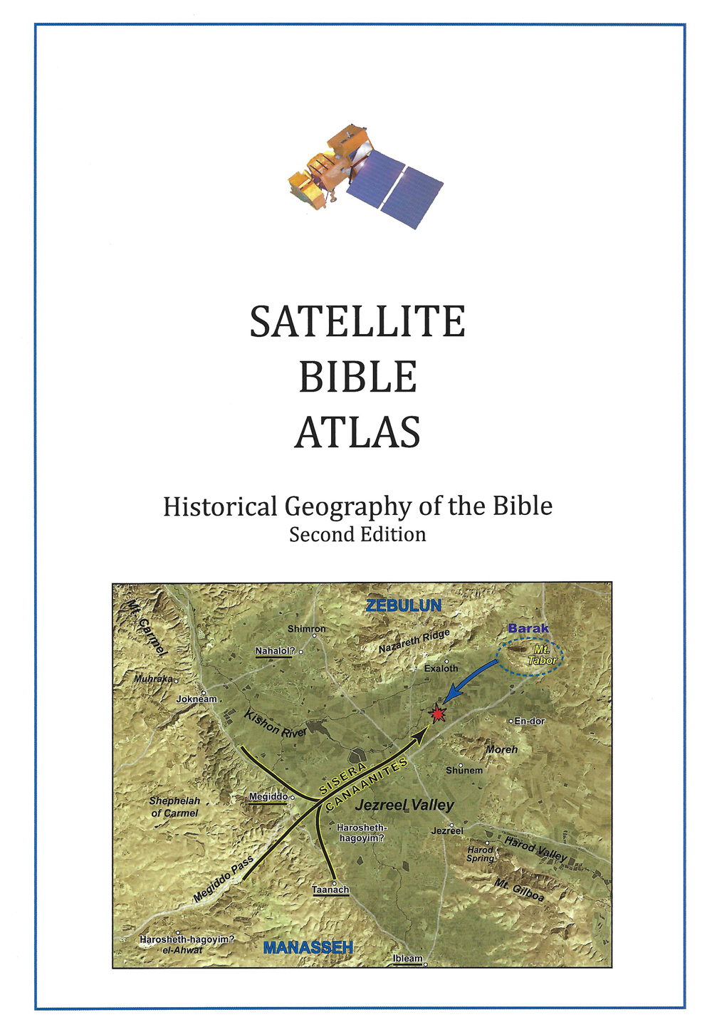
Links
Downloads
Dr. Cyndi Parker
Listen to the Land (Historical Geography)
BS600-12
The Shephelah
Lesson Transcript
All right. We have one more sliver of terrain to go through, except it's it's a sliver, and yet it is exceptional. We are still in the southern arena. We've been looking at where all the connections are. So anyone who lives down in the southern part of this city, Jordan, how do they get out? Where do they connect to? What are their natural resources? And we've been through lots of different kinds of landscapes. But I have one more I have to take you through. And this is called the shale. So the shale is sandwiched right in between the Philistine Coastal Plain and the Judean Hill country. It is a whole different geological area. It is shaped differently and it doesn't act like the coastal plain and it does not act like the hill country. So it is something completely unique and different. The even the term fella, it means lowlands in Hebrew. That's the name, which means we're looking at it from a point of view. It can only be the lowlands if you're up higher. Fraser We're seeing like this Israelite perspective, a hill country perspective of people looking down and going, Those are the low. It wouldn't work. If you're on the coastal plain, you'd be looking up towards the hills. Now this is a place where we're going to see Eocene. We haven't really interacted with Eocene, not a whole lot yet. We've done a lot of Sinfonia and in Santo Manian, but Eocene is going to be our primary limestone in this area, which is actually dictating the shape of this particular geography because of the Eocene. And when we were first exploring what Eocene looks like, you might remember pictures with the NARI crest and that like plastering white soft ness underneath it, that erodes down into brown forest soil.
[00:02:16] And we were talking about when we did our rock section, we were talking about it's in the valleys that all of this soil collects and is quite wonderful. Now, we're also going to see, because of the hill country appear, the field is going to be absorbing some of the runoff water from the hills. So it's going to be a well-watered area and it's also going to collect in the valleys some of the runoff soil from the hills. So it's very well situated to be a good agricultural zone now because it is in between the coastal plain and the hill country, which is the inhabitation put the points of inhabit, different people inhabit these areas. This is sandwiched right between them. We're going to expect this to be a place of conflict, which we're going to get to in just a little bit. We're going to describe this fella and this Eocene rock as being low rolling hills and wide open valleys. This is very different from what we saw in the hill country where they were deep, mangled, almost cliff faces, deep V-shaped valleys. This is a much softer kind of a landscape. So let me show you a picture. This is a pretty good aerial shot. And we're going to come back to this picture because this is a very famous valley. But we can see, just as we kind of glance over the picture, we can see that the hills are quite low, they're kind of gentle, the valleys are nice, and in between they create very distinct zones off in the haze. So when we squint at the blue, we're starting to pick up the foothills of the Judean Hill country that just continue to ascend. So we see how much higher those are going to get.
[00:04:13] So we're low in elevation, but we're not flat like the coastal plain is. This is the area that is very well known for grain all the way through those valleys. You might get some vines here and there. So if we were to put up a map of the rocks that we love so much, we get the cinnamon in that is here, we get the Eocene that is here. But you might remember, as we layer those rocks, cinnamon in on the very bottom, there's that thin layer of Snowdonia and chock before we get to Eocene. So if we're going to erode our way down to the Eocene or Eocene is still visible, we're, there's going to be a gap in there where the Sinfonia shows itself. Now we said the snow and takes on the shape of whatever rocket sitting on top of. And in this case this creates this nice little trough actually, and the trough becomes a really nice, easy area to travel through this fella. It's almost a narrow. Troll Road that is created by this break in between the limestones. So keep your eye on that as it runs diagonally through that Falla country. Okay. So let's put up our roads just as a point of reference so that we can keep track of where we are. Here is the patriarchal highway and I'm going to put a star on Jerusalem and that's not really going to move. So we're going to just so that we can keep figuring out where we are. This is the Philistine Coastal Plain, and so we know it has the two branches until we get further north and they join together into one. Okay. So in this field, we're now looking at these East West connections.
[00:06:06] So because of the Eocene, we have these nice big wide open valleys, and the valleys are going to run east, west and connect us from one zone to the other zone. And we get five of them, potentially six. There's some arguments that there's a six, but it's so narrow, it's really hard to pick out on maps. So I'm going to label all six, but you can only see five on this map so you can see how they're stacked. The biggest one is to the north. They get smaller as we go down. And on this map, they're colored green. So you can we have this nice, big, wide open one. We have one that looks like a smile. This one gets to be a little bit more wiggly. And now we're almost disappearing. And by the time we get down here, we can't see that sixth valley. Okay, so let's name them. The Northern One is the Ayalon Valley, and the Ayalon Valley is probably the most significant of our valleys, the island valleys, the one that's going to connect us up to the central Benjamin Plateau. The roads are going to come down into Gaza through the Ayalon Valley, into the international road as we continue south. The what the valley that looks like a smiley face to me anyway, is the Sauk Valley. And then we get the Ala Valley, Green Valley, Lachish Valley, and then at Ariah, maybe it's a valley like some people like to put it there. And we take that name from the city of Abraham that's up in the hills along that chalk moat. We're going to get what I'm going to call because of how I trained to understand this land. We always called this the diagonal road.
[00:07:49] It is connecting in the north and it runs to the south and to the west in a diagonal fashion out towards that coastal plain. Now, this is interesting. If we were to look at how this area functions because it has quite a distinct East West movement to it that we haven't really seen. Everything else is north south oriented. We've been moving north and south quite a bit. And for the first time locally anyway, we see this East-West connection. So how do we understand this? Dr. Paul Wright is the gentleman who trained me in geography, and he always uses this example that I think is actually quite good. So I'm stealing this from someone else. And he uses the imagery of swinging doors, you know, that have hinges on the outside, but they can swing in or out, depending on which direction you're traveling or how strong you are. So if someone on the outside is stronger, they can push their way in. Right. But if I am stronger, I can push my way out. That's exactly how this fella is acting. So if we have the Philistines over here on the plane and the Israelites over here in the Hill country, they're always kind of pushing at each other. And we can watch them historically as they push in and out through this fella. Neither people group ever really holding on to this fella consistently. It'll take a long time for Israelite Kings to really have a strong enough control of this fella. What is interesting is we also get archeologically. We can see the flipping back and forth. We get layers of philistine pottery, philistine style of home, philistine styles of cookery. And then on top of that will suddenly get Israelite style pottery, Israelite style homes.
[00:09:47] And we can see how it's if flips, different cities will flip in between Philistine control and Israelite control. So we have to understand this as the tug of war of power is happening all through this failure, East-West, through these valleys. Okay. As we continue to get to know the valleys, let's put up some roads were already familiar with. So these would be the roads that are coming down from the Central Benjamin Plateau. So here's Gideon. And there's two different roads you can take, but they're going to come back together again at the city of Ayalon, of the Ayalon Valley, before getting together. So this this is really fun. Let's think of Solomon. Solomon inherits a very strong kingdom. Solomon is up here in Jerusalem, but he has control of all these trade routes. We've already talked about that quite a bit. And then we get this interesting reference in First Kings nine, and it gives us a little glimpse into geopolitically what is happening. So in First Kings nine, actually, I'm going to set the stage even more. If you give me the freedom to do this, just build anticipation. We already met up with Joshua and the king of Jerusalem who gathered other kings together to fight Joshua. That battle happened up here on the central Benjamin Plateau. Joshua Winds. And he pushes them down into the Iron Valley. This is where the battle concludes, basically. We then later have, let's say if we were to think through the whole time, Saul is king and Saul, his jibia is his hometown. And the Philistines are always fighting there, always coming up through the Ayalon Valley, up onto the central Benjamin Plateau or just beyond. They're always kind of hanging out up here somewhere. Saul Often, often his son.
[00:11:40] Jonathan, actually. But Saul will then push the Philistines down. A couple of years later, the Philistines try again and they come up and there's a constant pushing. There's even a story. The Philistines go up. And this is later with David. And the Philistines are like, Oh, this isn't working so well. Let's go up a sneaky back way. Like a way that David wouldn't anticipate we'd go. And so they swing lower. But David is prepared for them. And David and the Philistines fight. And David pushes the Philistines back down this road so we can see this upper connection to the Iron Valley quite well. So we just map all these different stories onto the roads. So given all of this, it's really interesting for us to say at what point with all of the coming and the going of the Philistines and the Israelites back and forth this way. When did the Israelites finally take Geezer? When were they strong enough to keep this swinging door closed to the Philistines? Well, we have a story of David pushing the Philistines out this way, but it doesn't specifically say that David took Geezer a little hard to know. We get this story. Then in First Kings nine, where it says For Pharaoh, King of Egypt had gone up and captured Geyser and burned it with fire. Now he's from way down here and he's the one who comes up and captures the city and burns it. But then only kills the Canaanites who lived in the city and gave it as a dowry to his daughter, Solomon's wife. So Solomon rebuilt Gaza and the lower Bateman said, Lower Bateman is up here. So this is interesting because we could say, why does Pharaoh even care? Now, we don't have any other historical records of Solomon marrying into Pharaoh's family.
[00:13:40] We only get this reference. But it's interesting. Let's geopolitically puzzle this out. Why does Egypt care if the Israelites are controlling this? Well, Gaza is almost right on this road. Egypt cares because Egypt wants access to all of these international roads. If his daughter, the pharaoh's daughter, has married in Israelite, he has created a political agreement for open trade, and he has made sure the Israelites have the strongest city on that road to guard and keep it open for Egypt's interests. Right. Now when we look at the remains of Geezer, it's interesting. We have this six chambered gate. It's a very strong, very dominant kind of a gate. It would have been two stories tall, but this particular gate has six chambers. So three chambers on each side. Here's one, here's two, here's three. This is out of the city. We can see the the doorway of the city would have gone here. The sides of this gate would have been built up, like giving you a tower type look for the soldiers to be. So this gate of geyser, we are there's actually arguments over who exactly built this gate. But we're just going to call it an Israelite gate of one of the Israelite kings who controlled Geyser. Okay. So back to this fella. Okay. So the island valley, its roads, its connecting points. Let's continue working south. So what about the Sauk Valley? Well, there's a road that is going to connect us to Akron, the Philistine city of Akron. It goes through the valley and makes its way up a continuous ridge route until we get up here south of Jerusalem, just roughly in the Bethlehem area, right onto the patriarchal. Highway. Let's go further south to the ALA Valley. Well, the Ala valley has two branches of the road, so it's going to connect to Gath on the outer edge.
[00:15:56] And then through the valley. You can take one branch up here. It takes you to Bethlehem, or you can take one branch to the south, ascend up into the hills and get to Hebron. As we continue going further south green also, there's one. It kind of goes right through the valley, right through the edge of the valley. It is also going to connect up to Hebron. Lachish is going to connect the very important city of Lachish here and then out to the international coastal highway. It too roughly goes up to where Hebron is. And if I were to say, given everything that we see on the map. If I is the most significant valley, which is the second most significant valley. Yeah. And this is where I really love having people puzzle it out because people will sometimes say the Sword Valley because it's the next biggest. But I think what you just said is correct. The l.a. Valley. Why is they the valley? The second most important. It has to roads has more connections. So it is going to connect us either to Bethlehem or Hebron, which is the Napa natural capital city of the southern tribe of Judah. That's no small connection right there. So the Ala Valley is going to be our next significant valley. And at the far end of the ala valley, on the international road is a famous city of Gath. Well, we met up with Gath already. Gath is one of the pentathlon cities of the Philistines. It's a stronghold. It's a capital city for the Philistines. And there's a very famous warrior who comes from Gath. And this would be our friend Goliath, who was a Philistine from the city of Gath. Now we're going to read the story a little bit of David and Goliath looking primarily at the geography.
[00:18:00] But what we should look at and notice is that we've had all of these stories throughout all of Saul's reign of the Philistines coming up and down, up and down, up and down, up and down. Saul is still king, but it's towards the end of his kingship and we see the Philistines going. Let's try our second best option. Let's go through this valley, right? Strategically, you can see what's going on. And so reading this story in its historical context, it is as important as its geographical context. Hills of Judah After the in the far distance we have this little mound over here is the ancient site of Soho. And where I'm standing on this high hills in order to take this picture is a zarqa. A zarqa was a city that was built on a natural hill. And so we're looking to the east, which means directly behind us to the west, out towards the coast, is going to be gath. So just to places on this map. Who needs a first? Samuel, 17, tells us now. The Philistines gathered their armies for battle, and they were gathered at Soho. Oh, they're here. Which is almost in the Judean hills. Who has control of this valley? The Philistines. Do they? Just by giving us a location? Because the Philistines now have three quarters of the valley. Maybe even more. But they have the majority of the valley when they start to attack the Israelites. Okay. So they were gathered at Soho, which belongs to Judah. Obviously, Judah is not there. And they camped between Soho and Isiaka. Oh, well, that's fun. We're standing on a Zika, we're looking at Soho, and this is always fun. When I take people here, I'm like, okay, so given this, I mean, this is blocking some of the some of the view.
[00:20:00] But given this terrain, let's say you're in charge of the Philistines, where would you put your army? And it's fine to, like, puzzle that out a little bit and to go, well, it's somewhere between here and here. And the army has to be able to, like, get access. I love to put it in an elbow of the valley over here, but people have placed it all over the place. And you have freedom to do that kind of puzzle out your own battle strategy. Okay. So we continue on and it says Soul. And the men of Israel were gathered and camped in the valley of Allah and in Hebrew is says but m mc Ala. Now this is important because we have in Hebrew two different words for Valley. One Emek is like a flat valley with edges on either side. Another one is guy like guy. Ben Hanan, the valley of Ben Hanan. It's like this. It's a much narrower valley just slicing through the land. So this is guy. This is a mic. So in this case, Israel was gathered and camped in the valley of Allah, the flatter valley of Allah. So this is another really fun they drew up in battle array. And so many groups stand here and go, Where would you go? Where would you go? And some people put Israel here and the Philistines here. John Monson, who I learned a lot of geography from, puts Israel here with the hills of Judah to his back, which I think is actually really quite strategic. With look like looking at the valley that the Philistines pretty much have already taken. I like that version, but it's all kind of open for interpretation. Okay. So the the Israelites are there, the Philistines are there.
[00:21:54] So they draw up and battle array to encounter the Philistines. The Philistines stood on the mountain on one side while Israel stood on the mountain on the other side with the guy between them. So Israel has come down to this wide open valley. But when they're head to head, there's a guy between them. So, again, just to kind of place all kinds of Bible Atlas is they're going to put Israel here, Philistines here, but the ethnic is between them here. You know, just to be super picky. Whereas if you go back here, there are areas where the hills come so close together that there's more of a guy back here. So again, though, I'm influenced by those from whom I learned geography, but this is the fun of going and standing and trying to place things. Okay, said the rest of the story, which is really a lot more well-known than the geographical portion. We know that, in fact, in a very dramatic way, after Goliath comes out to shout at the Israelites, we almost get. If I were to use like a modern image, the camera that is recording the drama down here in the Ala Valley swings very dramatically up to Bethlehem. And Jesse is there going, Hey, David, can you take all this cheese? Again, evidence of the shepherding aspect of their career. Take all this cheese and give it to the guys who are watching over your brothers. Rick, give them protein. This is a very expensive gift. We want to make sure that your brothers are taken care of. Oh, and why don't you take this wheat and give it to your brothers, all right? So they can they can sustain themselves off of the grain. But the guys who are watching over them, we want to give them cheese.
[00:23:50] So David goes running off. But we could say, why is Jesse so concerned? One. He has boys who are involved in battle. But two, when we look at this, remember, there's two access roads from the Ella Valley. One goes that way to Bethlehem, which is where Jessie lives. One goes this way to Hebron. There's something about Jesse saying, Please make sure your boys are okay, that the army is okay, because if this goes south, we might be the next city that is taken. So we see a very personal interest in what's happening, but the political interest is also there as well. So David goes in in the famous part of the story, he fights Goliath. He kills Goliath. And then we get this interesting reference. Some were pulling out of the ala valley here. So here's the Zika where we were just standing. The men of Israel and Judah arose and shouted and pursued the Philistines as far as the valley and to the gates of Akron. And the slain Philistines lay along the way to Shah Orion, even to Gath and Akron. Well, it makes sense that the Philistines run to Gath and Akron, because those are the two cities of the pentathlon, cities that are inland. Here's Akron. Here's Gath. They've basically run on either side of a Zika and just headed somewhere south. Now, what's interesting is we get this other reference to another place called Shah Orion. And archeologists for the longest time have puzzled, like, what is Shah Orion? What is this a reference to? We don't know of any city that is called Shah Orion. It's so that's a little bit weird. The Hebrew short Orion actually is a dual gaits. So Shah is the Hebrew word for gait.
[00:25:52] Except that's also weird because any walled in city the gate is your most vulnerable place because it's a gap in the wall. And so cities don't have two gates. They have one gate. So that's then also interesting until recently when up on a hill and I should say I'll point out do you see right here right at the bend facing a. But on the eastern side right up on the top ridgeline of this place is a place called K Alpha. That's the modern Arabic name. So here Mitt K offer, which my Arab friends always say, your accent is terrible, so don't try to mimic me because I don't say it correctly. But as archeologist dug out this city because they they could tell remains were up there. So then it was like, let's just go and explore and see what this place has to offer. And as they explored the wall that went around this city. Right here. You may be able to squint and see something that looks like the gate that we just saw at Qasr. It has the opening in the wall and it has a couple chambers. This one is only a four chamber gate, but we're recognizing the pattern. So this is an Israelite gate. Oh, it's interesting, though, because if you go all the way around and you get over here and suddenly, oh, my goodness, look at that. There's another gate in the wall, the place of two gates. Kinda interesting. Again, this is such an unusual thing to have a city, a walled city that has two different gates. One gate. This one faces Soho into the ala valley. This gate faces a Zika. Right. That is just exactly to the west. Now, it's interesting because we have found other remains.
[00:27:51] There's tablets that has really old like prototype break writing that is on it. So it's an Israelite gate, Israelite city. It seems to be quite an early city. It was built maybe in the 10th century. Now, there's all kinds of arguments about this. But the archeologists who dug here would say this is a 10th century, which gives leads us into the time of Solomon and David. The thought is potentially David, after he becomes king in trying to fortify this fella and protect his interests up in the hills goes to this place that has significant to memory for him of the battle between the Philistines or Goliath and himself. And he takes a prominent hill with a good lookout, and he builds a city with a governor's house in the middle, two gates on either side to look up and down the valley and to watch and to pay attention. And it becomes known as Sha Ryan, the city of two gates. This is one interpretation. So if that is true and David builds this, then when this story is written down, which is not being written down exactly right, when it happens, once it's written down the story of David and Goliath. If David has already built Kafer, then people already know. Sure, Ryan. It's known in the modern people know that city exists. And so when the writer talks about where the Philistines go, they're like, Ah, they go beyond shot Orion to end up at Akron and Gath. So it's kind of an interesting way that this story unfolds. Okay. So just a couple more things. Let me say why this city lists matter. This is a classic, classic, classic thing is we're reading scripture. And as long as there's narrative and drama, we're like, ooh, what? Ooh, that's so interesting.
[00:29:51] Others betrayal. Oh, we love this, we love this. And then someone came and built and there's a list of cities and we go, blah, blah, blah, blah, blah, blah, blah. Okay, pick up the drama again. There's actually something that we need to know about these city lists. So this, I would imagine, would be not an interesting passage of scripture to read. So let's pull up our map instead. So we're at the time of Rehoboam. So the Kingdom of Israel has split into two northern kingdom of Israel, southern kingdom of Judah. And one of the things that Rehoboam has to do is fortify. There's there's rumors that one of the pharaohs is on his way out of Egypt, has heard of the rift between the Israelites and is on his way. And so he fortifies his city. This is what the chronicler is telling us. Let's just map out these cities and then you tell me what the biblical writer is telling us about what Rehoboam strategy is. Okay. So we have I put on the list Jerusalem knowing that Rehoboam is the son of Solomon. And in one of our previous stories we said Solomon, fortified lower Beit Toran and Geyser. So these are already fortified cities. Okay, so when Rehoboam has to fortify, he builds up Bethlehem, which you know, is south of Jerusalem, a tom, which is actually off the map. So we don't show it here. But let's go through Tekoa. We met up with Tekoa. That's Amos. We have Bajor, which is done by Hebron. We have Soho. We've already seen Soho in the Alpha Valley, Adu Lam, which is very close to Soho on the way to Hebron. Gath probably Gath to the Philistines. Marcia Ziff at Orion Lachish Azteca, where we've already been, Zora Ayalon and Hebron.
[00:31:52] What is Rehoboam doing? This list of cities is not just a random list. He is fortifying the roads. And so, look, we have from Hebron. Each branch of the roads coming up to his fortified knowing that the pharaoh could come from the south. Every single road coming through the Shaila has something that has been fortified, including the diagonal road running through the field that is heavily fortified. We have a few places out here already on the coast, but he's really trying to create this blockade, lock all the gates shut to make sure Pharaoh can't get into the hill country. And then, of course, he's going to anything that is south of Jerusalem. Let's try to make sure that the pharaoh doesn't come up that way. So it all again, it makes total sense. So with every city list that you get, map them. We start to see at this time. So Rehoboam also it continues on Chronicles. Does he also strengthen the fortresses and put officers in them and stores of food, oil and wine? So he's not only fortifying places, but he's redistributing resources to make sure those areas have enough supplies to hold them there. Okay. So let's finish out the geography of Australia by bringing in a few of our profits. I really love comparing Micah and Isaiah. I mean, Isaiah is a really big book and there's a lot of complicated, like when we really look at understanding the book of Isaiah it's complicated. But Isaiah the person and Micah the person were contemporaries. Micah is from here in this fella. Isaiah is from here in Jerusalem. So he's an urban guy. And even that is really interesting because we often find Isaiah in his book addressing the elite and the king of Jerusalem.
[00:33:56] Micah is addressing everyone else. And Micah, when you read his book, is basically shouting, he's so angry. He's all this passion and fervor in his voice. I mean, that's how I read it, anyway. Very passionately as Ari, his strong words to say. Some of it is directed to the elite up here. So you could say sometimes he's addressing the same people, but with much, much harsher language. Why? Okay. Let's add a little history and look at our geography. This is our diagonal road. Right. So Micah lives on the diagonal road. And if we put Micah in context, Micah and Isaiah, it's there at the same time that the Assyrian empire is moving out of Mesopotamia and coming south. Right. So we get things like records from the Assyrians. Of them going and attacking and destroying Asaka just north of where Micah is from. And their records, their own Assyrian inscriptions, say and Shar, my lord supported me. And to the land of Judah, I marched in the course of my campaign, the tribute of the Kings. I received the district of Hezekiah, of Judah, this city of a Zarqa, his stronghold. And he goes on to talk about all the all the bounty of goods that he took out of the city and how it was hard, but he won. He destroyed the city. Now, he also. Have you ever go to the British Museum? You'll see an entire section. There's a whole entire room dedicated to the depiction of the conflict between Assyria and Lachish. And again, it's another one of those sennacherib going. This was such a hard battle. It was so crazy. It took a long time. We were fierce. They were, you know. And he found it worthy enough to post in his throne room back in Nineveh.
[00:35:58] So it's constantly there is a reminder of his greatness. So these depictions are really interesting. We can see it's the Assyrians who've built the siege ramp up against the gates of Lachish. We can see the shields and their bows and army. We get the depiction of one of the towers of the Israelites. These are Israelites who are up here shooting down on the Assyrians. We even have a little war machine here with a battering ram. They're pushing up towards the gates. That's all very dramatic because we have fiery arrows that are being shot down onto the Assyrians and they're using ladles full of water to put out the fire. Right. The whole thing. It's a entire drama that just unfolds in front of you. Okay. So if we're looking at Sennacherib taking a zarqa boasting about it and Sennacherib taking lachish and boasting about it, let's think of Micah being here in between the two. Now, we don't know exactly what Micah saw exactly when, but this is his historical and political context. So if we go, why is Micah so like up in arms and using such fierce language when Isaiah is using very diplomatic and he has harsh words to say, but it's not yelling. And I say, Micah, Micah's life was in danger. Isaiah's life wasn't yet in danger. And it comes out in the tone of the writing. Micah You should read like someone who see someone crossing the street and a bus is coming at them. You don't go. I'm sorry. Excuse me. If you would just take a moment and notice that there is a vehicle traveling towards you at a high velocity. And I don't like the, you know. Right? No. In that kind of context, you go get out of the way.
[00:37:56] You yell and you scream. That's Micah. Next time you read Micah, read it like that. Isaiah is up here negotiating and there's a whole different tone to the book. Okay. So with that, we have concluded our southern arena and all the diversity of its geography. So let me just take a moment and ask if there's any questions before we take a break. So there was a lot of fighting and warfare going on constantly. And the big ones we know about are the ones where Syria or Babylon came in. And that was not really much of a contest. Yeah, but with the Philistines, that was a constant concern. Mm hmm. So the king had to be concerned not only about, like, getting territory or something, but just protecting the. That's right there. Yeah. They spent a lot of time doing that. Yes. And it's great once we read layers and layers and layers and layers of these battles, and it's it's all these small kingdoms. It's the Israelites, the Philistines, Moab, Ammon, you know, they're the small kingdoms that are throwing elbows, trying to create more space for themselves. So once we do that and then we read the texts where God is saying, stop being so strategic politically, stop creating these alliances, trust me. But when you put yourself in their shoes, you're kind of like, I don't want to. Like, that does not seem smart. I think it would be smart if I also created a political alliance with maybe someone like Egypt who I know is going to protect me. So you're right, though, like being able to look and see. They're always at war, they're always at conflict, they're always about to lose. But that helps us again, understand them and the faith decisions that they have to make.
[00:39:46] And realizing sometimes we're very flippant. Why didn't the Israelites trust God? Why didn't they? It's so obvious God is to be trusted because they're seeing him right across the. That's exactly right. Because the soldiers are in my face. And it's easy for us to be flippant with people long ago, because in our own lives, it's not like we are all that better at trusting God. But we should be.