Listen to the Land (Historical Geography) - Lesson 11
Benjamin
Benjamin has the smallest tribal allotment but it is one of the most significant areas in the nation of Israel. The geographical features, the cities located there and the roads that run through it make it a region of national and international importance.

Benjamin
I. Location
A. Cities
B. Roads
C. People
D. Gibeon
II. Central Benjamin Pleateau
- 0% Complete
The land influences the people that are living on it by affecting their stories. Learning to listen to the land helps you understand the details that are hiding in the background so that when you read the Bible, it’s like you see the narrative in living color and 3 dimensions.
0% Complete - 0% Complete
Major rivers in the Ancient Near East provided the resources necessary for empires like Egypt, Assyria, Babylon and Persia to grow and flourish. Israel is on a couple of the major trade routes that connects these cultures. The location of mountains, hills and valleys in Israel affects the lifestyle and travel patterns of the people who live there and the people travelling through.
0% Complete - 0% CompleteLearn how the geography and climate of the Cisjordan and Transjordan regions shape agricultural and shepherding activities, emphasizing the importance of rain patterns and water management techniques in biblical times.0% Complete
- 0% CompleteLearn how the granite, sandstone, and three types of limestone shape the lifestyle, agriculture, and building practices in the biblical lands, highlighting the geological factors that influence whether inhabitants are migratory or sedentary.0% Complete
- 0% Complete
Bashan is in the north and has enough rainfall and arable soil to support crops and large animals like cattle. The Dome of Gilead provides connection points for international and local travel. Ammon and Moab are neighbors and descendants of Lot’s daughters. Edom is south and are descendants of Esau.
0% Complete - 0% Complete
The people that migrated to live in the coastal plain were known as the Philistines. Because of the location and terrain, the roads were sources of international travel and trade. Cities were built for commerce and control. The Negev was an important area to control for travel.
0% Complete - 0% Complete
The Rift Valley is valuable because of its location and resources. Bitumen and Balsam were sought after. It was a popular trade route but it was important to know where to get water. Jericho was at crossroads and was near some major springs. Connecting events in biblical history to the event and location of the baptism of Jesus adds weight and significance to it.
0% Complete - 0% Complete
The hill country of Judah has enough rain to grow grapes and other crops. Hebron was first given to Caleb and then was the city that David ruled from when he first became king. It was a connecting point for local roads. Bethlehem and Tekoa are also cities in this area.
0% Complete - 0% Complete
Jerusalem is framed by the hills and valleys that are near it. The Sorek Wadi System is to the west and the Mount of Olives is to the east. David built a palace and Solomon later built a temple. Jerusalem was important in Jewish history and also has a place in eschatology.
0% Complete - 0% Complete
By the beginning of the first century, Jerusalem was the site of a magnificent Jewish temple built by Herod the great. He also built an impressive palace and a Roman fort which overlooked the temple. The events leading up to the crucifixion of Jesus take on added layers of meaning when you understand how the geography of the events reminded people of Messianic prophecies.
0% Complete - 0% Complete
Benjamin has the smallest tribal allotment but it is one of the most significant areas in the nation of Israel. The geographical features, the cities located there and the roads that run through it make it a region of national and international importance.
0% Complete - 0% Complete
The Shephelah is between the hill country and the coastal plain and has unique geographical features. When you know the location of the roads, valleys and cities in this area, you can see their significance in the stories. When you understand where Micah and Isaiah came from and their historical context, you can understand why there is a difference in their message and tone.
0% Complete - 0% Complete
The rocks and roads will give you valuable information about the Sharon Plain and Mt. Carmel. The international road took different paths around Mt. Carmel depending on your final destination. The harbor and palace that Herod built in Caesarea were impressive.
0% Complete - 0% Complete
The hill country of Joseph has abundant resources and nearby roads for commerce. Shiloh was a religious center and the place where Joshua met with representatives from each tribe to determine their tribal allotment. The women of Shiloh also were instrumental in saving the tribe of Benjamin. Shechem was important as far back as Abraham. Every time people would see Mt. Gerizim and Mt. Ebal, it was a reminder of the blessings and curses of their covenant with God.
0% Complete - 0% Complete
Who was Omri, and why was he significant in making Samaria an important city? When the people of Judah returned from Persia, there was a conflict with the people of Samaria. The animosity that was still present during the ministry of Jesus set the stage for an encounter he had with a woman that was at a well near the city.
0% Complete - 0% Complete
Upper and Lower Galilee have the climate soil that is conducive to widespread agriculture. Lower Galilee also has some valleys that became major roads. Major empires of the fertile crescent exerted their influence here as they expanded. When the Greeks took control with their military, they also spread their cultural influence.
0% Complete - 0% Complete
The Jezreel Valley is the center of activity for many of the biblical narratives. Not only was it an important economic and strategic location for Israel, but also for the Canaanites, Egyptians, Arameans and Assyrians. It is also a place where significant events took place in the lives of the prophets and Jesus.
0% Complete - 0% Complete
This body of water is often referred to as a, “sea” even though it is fresh water, not salt water. There are not many stories in the Hebrew Bible that take place in this area, but it is a center of activity for Jesus during his ministry. Many of the parables are illustrations taken from local culture and geography.
0% Complete - 0% Complete
The Huleh basin has an abundance of water from several sources. The soil is also good, but the conditions for growing crops in some areas presents some challenges. Dan is a strategic city in the north as a gateway to the region and a religious center under Jeroboam. Caesarea Phillippi was built by Herod and was a place that Jesus used to teach his disciples about his role as Messiah and their future as leaders of the church.
0% Complete - 0% Complete
The Gospel of Luke traces the journey of Jesus to Jerusalem, and the book of Acts traces the journey of the gospel going out from Jerusalem. The events in Pentecost have a connection to the events at Mt. Sinai. The gospel is for the world but the events that made it possible are anchored in Israel. (Don't forget the Epilogue, Lesson 21!)
0% Complete - 0% Complete
There are two different stories in the Gospels of Jesus feeding large groups of people. One account is in John 6 and another account is in Mark 8. The message is similar but the geography gives you some clues to help you understand why the details are different.
0% Complete
Have you ever read about a place and when you went there in person, it came alive? As you walk through the hills and valleys of Israel with Dr. Parker, you will see the stories of the Bible in living color.
Your location affects your lifestyle, relationships, worldview, occupation, diet and travel. In ancient Israel, you depended on the resources around you to survive. People often lived near springs or rivers, but it was possible in some places to collect rain water and ration it through the year. The terrain and the type of soil would determine what crops you could grow, or what animals you could raise. Living near a road would give you opportunities to sell what you produced or buy what you needed. Your location would determine the amount of risk you would face from people in neighboring countries. By living in the hill country, you would develop a different mindset than if you lived on an open plain.
Once you begin to have an understanding of the, "rocks and roads" of Israel, reading your Bible with a good map next to you will help you get a 3 dimensional perspective. When the characters and the scenery become life-like in your mind, you will find yourself being inspired and motivated in your understanding of your relationship with God and how you can apply it in your interactions with others. Take this opportunity to learn from Dr. Parker to "Listen to the Land!"
Recommended Reading:
Encountering Jesus in the Real World of the Gospels, by Dr. Cyndi Parker
Holman Illustrated Guide to Biblical Geography, by Paul Wright
Satellite Bible Atlas: Historical Geography of the Bible
Recommended Books
Listen to the Land: Historical Geography - Bible Study
Have you ever read about a place and when you went there in person, it came alive? As you walk through the hills and valleys of Israel with Dr. Parker, you will see the...
Satellite Bible Atlas
A comprehensive guide to biblical geography, The Satellite Bible Atlas by William Schlegel provides historical context and insightful maps to help readers better understand the world of the Bible.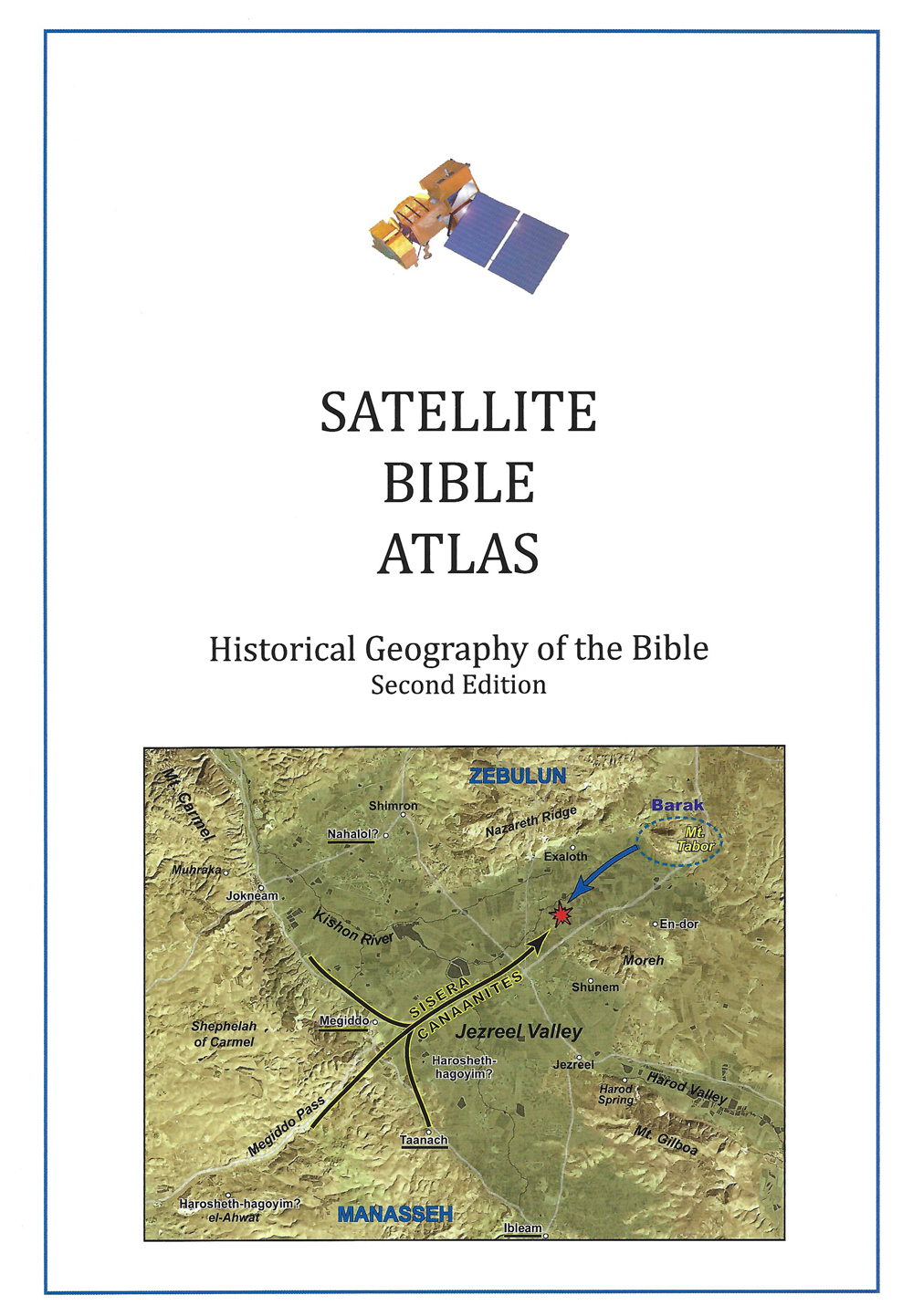
Links
Downloads
Dr. Cyndi Parker
Listen to the Land (Historical Geography)
BS600-11
Benjamin
Lesson Transcript
Okay. So I have the star on Jerusalem. I put it on the road, but we all know now it's slightly off the road and we're going to look at Benjamin's territory. If we were to define Benjamin's territory, and I'm doing this specifically, I know I haven't done this with all the other tribes, but Benjamin gets the smallest of all of the tribal allotments. But it's probably one of the most significant. Or there's an argument to be made for that. So we can define the territory of Benjamin by looking at Jerusalem marking its southern border and Bethlehem marking its northern border. Bethel also being right on the patriarchal highway. Well, what about east to west? Well, we could say Jericho to the east. And then I'm going to say Gaza off to the west. So you can see how we get almost a diamond, a really flat diamond shape. It is draped over the spine of the hill country. Now the hills ascend to the north and the hills ascend to the south. So Benjamin's area is actually in a in a saddle in the hills, which makes it less difficult to get there. So it is quite narrow, but you should maybe as budding geographers who have been paying attention and obsessed with maps as I know that you are by now, should already start going, Oh, wait, but we're familiar with Jericho and the connections Jericho has. So let's put those connections on the map. We talked about these three roads and the significance of Jericho being here and having three access points up to the hills. Two of them come directly into Benjamin's territory.
[00:01:59] One goes to Jerusalem. One hits the exact center Benjamin's territory. The other one comes just barely north of Bethel. So Benjamin almost has all three access points, but not quite. But now let's look over to the West. There is one road that leads off and then it splits into two. And this heads out together and gathers practically on the international coastal highway. So Benjamin can hold on with both hands. International Road, too? Not quite. International Road, but one of the most significant crossings of the Rift Valley. Now, if I were to show you this map, as I have shown you this map, I would say if you were in Benjamin. Is there a territory in particular? You would be very cautious to want to protect really super valuable territory. And aside from Jericho maybe and Gaza, which are almost international cities, you might draw your eyes to the very center. Why? Because the northern road is meeting up with your only East-West access points. Think about how dramatic this is. When we looked at Hebron, Hebron didn't have an eastern axis, western and southern and northern, but no eastern Jerusalem, of course, we already know super protected. But this area has north, south, east and west connection points. It is also because it's a depression in the hills. It is almost what we call it, a plateau. It's not flat. Flat. But if you've been dealing with these hills, it's flat. Right. And this controlling this hill or that central Benjamin Plateau is massively significant. Now we see different references, almost offhanded references to the inhabitants of Benjamin's territory. Every time they refer to the Benjamin, it's they're almost always these mighty amazing men. So, for example, in Judges, when Benjamin's are described out of these inhabitants of Jibia and Jibia is right here.
[00:04:13] So it's close to the plateau. Jibia also happened to be the. Well, not yet, because we're in Judges, but it will be the home place of Saul. But we're describing the inhabitants of Jibia. We have 700 choice men who were left handed. Each one could sling a stone at a hair and not miss. He is amazing. We'll get first chronicles. This is describing some of the men who followed David. They were equipped with bows using both the right hand and the left to sling stones and to shoot arrows from the bow. They were solo kinsmen from Benjamin. So we get these references. Oh, you know those guys, they're really good to have in your army because they fight with both hands because they're precise in their ability to deliver a stone into the forehead of someone or to fight with the right hand and with the left hand. And you might go, Well, is that just a natural ability of Benjamin, of the Benjamin's, or is their territory influencing so much that they're very accustomed to having to fight for their land and they, due to the external pressures, end up honing their abilities to fight? We could maybe go either way with that argument. Maybe it's a mutually maybe it goes both ways, I don't know. But it's interesting to see the way the reputation of the Benjamin's. Okay. So understanding all of this geography, let's thing go. To this story. This is a story we put a pause on when we followed Joshua and the Israelites into the land. So, Joshua, the Israelites have crossed the Jordan River. They're in the vicinity of Jericho and they've conquered Jericho. They're in the process of coming up some of these wilderness roads. And there's been a battle at eye, which is potentially right up here.
[00:06:13] Okay. So it's time for people in the hill country to get nervous. So the first thing we get is the people of Gideon. Gideon is here on this central Benjamin Plateau. In fact, Gideon is the most significant city that is on this plateau. So we can say Gideon, Mitzpe, Rama and Jibia. Form this plateau. So now we get the inhabitants of Jibia. And they've heard what Joshua had done to Jericho and to I. So they acted craftily and set out as envoys and took worn out sacks on their donkeys and wine skins, worn out and torn and mended and worn out and patch sandals on their feet and worn out clothes on themselves. And all the bread of their provisions was dry and had become crumbled. And they go to Joshua at the camp of Gil GAO, and they say, Oh, we have come from so far away. Now. Why are the people who give in so afraid of Joshua? Why is Joshua such a threatening presence to them? It only takes one day to walk down to Jerry because they're actually not all that far away. But this is another one of those are the geography tells us, Jericho, if you were able to conquer Jericho, that's saying something. Because Jericho had a mighty wall around it, had all the springs, all this food, all this water. Joshua has access to all three of the routes into the Hill country, and we already said, but which one is the most significant that you would really want to hold onto of possible would be this one. And so it doesn't take a genius to know if we're here. We're next. Like, Joshua is on his way. And strategically, this is the most strategic territory for Joshua to take.
[00:08:07] Better for us to make a covenant with Joshua than to risk falling to his sword. And so they make this covenant, the people of Libya. Well, let me show you that Central Benjamin Plateau so you can see it's it's just kind of a little bit bumpy. So it's not tabletop flat, but this is a good plateau area. And this mound that sits right in the center, this is Jibia. And so you can see from Jibia, look at that view you have all the way around. You can see how it just kind of dominates the plateau. It is the king of the plateau. And so these are the people that make a connection with Joshua, which doesn't go unnoticed. Now, it came about when Adonai Zedek, King of Jerusalem, heard that Joshua two captured AI and had utterly destroyed it, just as he had done to Jericho and its king. So he had done to I and its king, and that the inhabitants of Gideon had made peace with Israel and when were and were within their land. That he feared greatly, because Gideon was a great city, like one of the Royal Cities, and because it was greater than I and all of its men were mighty. All right. So Jerusalem is under the words printed on the screen, but we've spent a lot of time in Jerusalem. Why is the king of Jerusalem worried? While the greatness that Joshua has proven, the greatness of his God. But there's a strategic reason why the king of Jerusalem in particular, is worried. Put yourself in his position. Let's say, let's see Jerusalem. If I can see through the map. Jerusalem is here. What's on this side. The short wadi system. What's on this side? The Mount of Olives in the wilderness.
[00:09:58] Where's your east west connection? You might you have access north, south, as long as you can get out onto the road. You have north south, but you have no way to get east west. So you're somewhat isolated in the hills. If Jerusalem is looking at who Gideon has gone over to Israel. Jerusalem knows my access point is cut off. I no longer have any kind of access to the West, and he isn't going to have access to the East because Joshua is down here. So there's no way. So he's hemmed in to the hills and can't go anywhere. So by Joshua taking this plateau, it puts Jerusalem immediately in risk. And so he gathers a bunch of kings, and they go to attack Gideon, who then goes to Joshua. Hey, look, man, you're supposed to be protecting us, and now we're under attack. And then, strategically importantly. Joshua and his men hike up the road at night. So they're going through the wilderness and they're going to come up onto the plateau where the battle is taking place. Now, let's say you are laying siege and the battle is like now onto the plateau. If Joshua's army comes from the east, when this army turns to face them, the sun is in their eyes because Joshua is hiked through the night. It's a really clever way to use his geography, and then they are going to win and they're going to push them down into the valley. And then ultimately Joshua is going to kill those kings. So in the way, like as the book of Joshua is telling us this story, their first entrance into the Hill is at a very strategic point where they basically cut the spine in half and paralyze the inhabitants who are up there.
[00:11:57] Okay. So just to put on the map what I had already mentioned, the central Benjamin Plateau then is going to be Gideon, this king of the plateau. Mitt's per rama. Rama was Samuel's hometown when Samuel, during his prophetic ministry. Rama is where he often like went back to considered home and Jibia, which was Saul's hometown. So some pretty strategic cities that are all right here, right along the plateau. When we get to the troublesome period when Benjamin now is creating this wedge between the Northern Kingdom of Israel and the Southern Kingdom of Judah for 50 years, once the kingdom splits into two, it takes 50 years for them to figure out who's going to take Benjamin. And there's so much activity at this time where the north and the south are coming at it from both directions, fighting desperately. What are they fighting for over this small territory? It's all about this area and the connections to the east and to the west. So we get stories like this in First Kings 15. Now there is war between Eisa and Basha, king of Israel. All of their days they share King of Israel went up against Judah and fortified Rama, which is right there in the middle at the crossroads. So he fortified Rama in order to prevent anyone from going out or coming to King of Judah, quite literally. He's taking the crossroads. Who's getting to Jerusalem? This is a strong move. If he is taken Rama in is fortifying Rama. He's taken the whole plateau. He basically is taking Benjamin's territory. Okay. Now is not going to sit back and take that. So Issa is going to send emissaries up to Damascus, up in the far north corner of the map that we've seen during other lessons, pays them a whole bunch of money and says, could you please start attacking the northern part of the northern kingdom? Aram Damascus is happy to comply.
[00:14:16] Thank you for even paying me to do that. That's fantastic. So, of course, now Basha is fighting a war on two fronts. He's fighting one down here, over Benjamin. But now he has to fight Aram Damascus in the north. And so he retreats to go north to help support his people up to the north. And Aissa is going to take great advantage of that. So when she heard of it, he ceased to fortifying Rama and remained in Terzi, which is the capital city of the Northern Kingdom. Then King Eisa made a proclamation to all of Judah. None was exempt that they carry away the stones of Rama and its timber with which Basha had built and King Isa built with them. Gather of Benjamin and Mitzpe. Where are those? Well, Gebre is just to the east and mitzvah is just to the north. What has he done? He was in a bottleneck here with Israel, northern Kim of Israel basically taking everything and he dismantles the fortifications here, pushes one further north, pushes one further east. He's just opened an entire gateway for him, and he now could have connection down to Jericho through Road. And he has open connection to the West, which is what he is more concerned about. So by the time we get through the 50 years of battles and pushing back and forth, the final division between North and south is going to be on that green line roughly. This is kind of big brush strokes where Bethel is going to be along to the Northern Kingdom. Jericho belongs to the Northern Kingdom. Everything else belongs to the Southern Kingdom. Jerusalem is able to keep their access to the West open and protected, along with Gaza down all the way far to the west, connecting them to the international coastal highway.
[00:16:16] So all of these battles that we kind of read or we just don't see why they're so significant, like we are becoming accustomed to seeing and hopefully addicted to seeing is once you put it down on to the map, you start to go, Oh, I see. I see exactly why that happened.