Listen to the Land (Historical Geography) - Lesson 5
The Transjordan
Bashan is in the north and has enough rainfall and arable soil to support crops and large animals like cattle. The Dome of Gilead provides connection points for international and local travel. Ammon and Moab are neighbors and descendants of Lot’s daughters. Edom is south and are descendants of Esau.

The Transjordan
I. Bashan
II. Gilead
A. Geography
B. Ammonites
II. Mishor and Moab
A. Moab
B. Two international roads
C. Origin of the people of Moab
III. Edom
A. Soil and geography
B. Origin of the people of Edom
- 0% Complete
The Historical Geography of the Land of the Bible is a course that aims to explore the secrets of the land of the Bible by learning how to pay attention to details like rocks, water, and roads, and how they have a dramatic impact on the people living in that context and will change our theology.
0% Complete - 0% Complete
The land influences the people that are living on it by affecting their stories. Learning to listen to the land helps you understand the details that are hiding in the background so that when you read the Bible, it’s like you see the narrative in living color and 3 dimensions.
0% Complete - 0% Complete
Major rivers in the Ancient Near East provided the resources necessary for empires like Egypt, Assyria, Babylon and Persia to grow and flourish. Israel is on a couple of the major trade routes that connects these cultures. The location of mountains, hills and valleys in Israel affects the lifestyle and travel patterns of the people who live there and the people travelling through.
0% Complete - 0% Complete
Wind patterns and the shape of the land determine where more rain falls. Finding and managing sources of water is a critical aspect of survival. The feasts coincide with the agricultural calendar. Biblical passages containing references to water and the feasts had profound meaning to the original audience.
0% Complete - 0% Complete
Of the granite, sandstone and limestone layers of rock, the limestone layer is what controls much of the lifestyle of the people. The layers of limestone that are common throughout Israel and the surrounding areas are Cenomanian, Senonian and Eocene. It is a good land because there are enough resources to survive and thrive, but it is not an easy land. It has been referred to by different names throughout the years and the political boundaries have been fluid.
0% Complete - 0% Complete
Bashan is in the north and has enough rainfall and arable soil to support crops and large animals like cattle. The Dome of Gilead provides connection points for international and local travel. Ammon and Moab are neighbors and descendants of Lot’s daughters. Edom is south and are descendants of Esau.
0% Complete - 0% Complete
The people that migrated to live in the coastal plain were known as the Philistines. Because of the location and terrain, the roads were sources of international travel and trade. Cities were built for commerce and control. The Negev was an important area to control for travel.
0% Complete - 0% Complete
The Rift Valley is valuable because of its location and resources. Bitumen and Balsam were sought after. It was a popular trade route but it was important to know where to get water. Jericho was at crossroads and was near some major springs. Connecting events in biblical history to the event and location of the baptism of Jesus adds weight and significance to it.
0% Complete - 0% Complete
The hill country of Judah has enough rain to grow grapes and other crops. Hebron was first given to Caleb and then was the city that David ruled from when he first became king. It was a connecting point for local roads. Bethlehem and Tekoa are also cities in this area.
0% Complete - 0% Complete
Jerusalem is framed by the hills and valleys that are near it. The Sorek Wadi System is to the west and the Mount of Olives is to the east. David built a palace and Solomon later built a temple. Jerusalem was important in Jewish history and also has a place in eschatology.
0% Complete - 0% Complete
By the beginning of the first century, Jerusalem was the site of a magnificent Jewish temple built by Herod the great. He also built an impressive palace and a Roman fort which overlooked the temple. The events leading up to the crucifixion of Jesus take on added layers of meaning when you understand how the geography of the events reminded people of Messianic prophecies.
0% Complete - 0% Complete
Benjamin has the smallest tribal allotment but it is one of the most significant areas in the nation of Israel. The geographical features, the cities located there and the roads that run through it make it a region of national and international importance.
0% Complete - 0% Complete
The Shephelah is between the hill country and the coastal plain and has unique geographical features. When you know the location of the roads, valleys and cities in this area, you can see their significance in the stories. When you understand where Micah and Isaiah came from and their historical context, you can understand why there is a difference in their message and tone.
0% Complete - 0% Complete
The rocks and roads will give you valuable information about the Sharon Plain and Mt. Carmel. The international road took different paths around Mt. Carmel depending on your final destination. The harbor and palace that Herod built in Caesarea were impressive.
0% Complete - 0% Complete
The hill country of Joseph has abundant resources and nearby roads for commerce. Shiloh was a religious center and the place where Joshua met with representatives from each tribe to determine their tribal allotment. The women of Shiloh also were instrumental in saving the tribe of Benjamin. Shechem was important as far back as Abraham. Every time people would see Mt. Gerizim and Mt. Ebal, it was a reminder of the blessings and curses of their covenant with God.
0% Complete - 0% Complete
Who was Omri, and why was he significant in making Samaria an important city? When the people of Judah returned from Persia, there was a conflict with the people of Samaria. The animosity that was still present during the ministry of Jesus set the stage for an encounter he had with a woman that was at a well near the city.
0% Complete - 0% Complete
Upper and Lower Galilee have the climate soil that is conducive to widespread agriculture. Lower Galilee also has some valleys that became major roads. Major empires of the fertile crescent exerted their influence here as they expanded. When the Greeks took control with their military, they also spread their cultural influence.
0% Complete - 0% Complete
The Jezreel Valley is the center of activity for many of the biblical narratives. Not only was it an important economic and strategic location for Israel, but also for the Canaanites, Egyptians, Arameans and Assyrians. It is also a place where significant events took place in the lives of the prophets and Jesus.
0% Complete - 0% Complete
This body of water is often referred to as a, “sea” even though it is fresh water, not salt water. There are not many stories in the Hebrew Bible that take place in this area, but it is a center of activity for Jesus during his ministry. Many of the parables are illustrations taken from local culture and geography.
0% Complete - 0% Complete
The Huleh basin has an abundance of water from several sources. The soil is also good, but the conditions for growing crops in some areas presents some challenges. Dan is a strategic city in the north as a gateway to the region and a religious center under Jeroboam. Caesarea Phillippi was built by Herod and was a place that Jesus used to teach his disciples about his role as Messiah and their future as leaders of the church.
0% Complete - 0% Complete
The Gospel of Luke traces the journey of Jesus to Jerusalem, and the book of Acts traces the journey of the gospel going out from Jerusalem. The events in Pentecost have a connection to the events at Mt. Sinai. The gospel is for the world but the events that made it possible are anchored in Israel. (Don't forget the Epilogue, Lesson 21!)
0% Complete - 0% Complete
There are two different stories in the Gospels of Jesus feeding large groups of people. One account is in John 6 and another account is in Mark 8. The message is similar but the geography gives you some clues to help you understand why the details are different.
0% Complete
Have you ever read about a place and when you went there in person, it came alive? As you walk through the hills and valleys of Israel with Dr. Parker, you will see the stories of the Bible in living color.
Your location affects your lifestyle, relationships, worldview, occupation, diet and travel. In ancient Israel, you depended on the resources around you to survive. People often lived near springs or rivers, but it was possible in some places to collect rain water and ration it through the year. The terrain and the type of soil would determine what crops you could grow, or what animals you could raise. Living near a road would give you opportunities to sell what you produced or buy what you needed. Your location would determine the amount of risk you would face from people in neighboring countries. By living in the hill country, you would develop a different mindset than if you lived on an open plain.
Once you begin to have an understanding of the, "rocks and roads" of Israel, reading your Bible with a good map next to you will help you get a 3 dimensional perspective. When the characters and the scenery become life-like in your mind, you will find yourself being inspired and motivated in your understanding of your relationship with God and how you can apply it in your interactions with others. Take this opportunity to learn from Dr. Parker to "Listen to the Land!"
Don't forget the Epilogue, Lesson 21!
Recommended Books
Listen to the Land: Historical Geography - Bible Study
Have you ever read about a place and when you went there in person, it came alive? As you walk through the hills and valleys of Israel with Dr. Parker, you will see the...
Satellite Bible Atlas
A comprehensive guide to biblical geography, The Satellite Bible Atlas by William Schlegel provides historical context and insightful maps to help readers better understand the world of the Bible.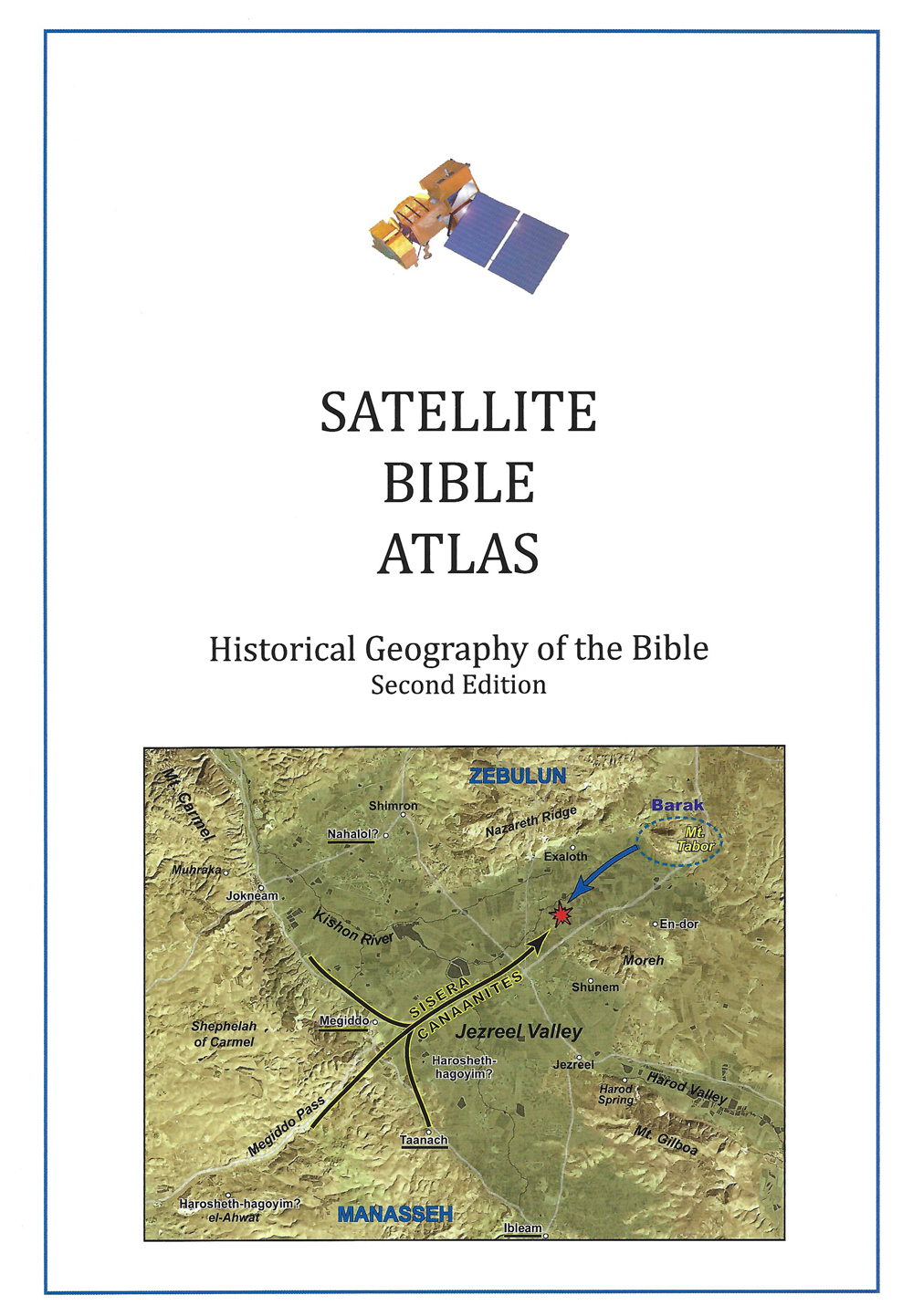
Links
Downloads
Dr. Cyndi Parker
Listen to the Land (Historical Geography)
BS600-05
The Transjordan
Lesson Transcript
Okay. So we've been doing so much big picture work just setting in general how the land functions in general, what are the rocks? So now it is time for us to go region by region and really start to look at the details in the region. So to go back to the analogy of the painting at the Art Museum, we've done the frame and we've done the overall look of the painting. And now we're going to really look at how each brushstroke in different section of the painting really adds to the artistry of what's going on in this painting. So I'm actually going to break with tradition. If you look at a lot of Bible atlases or anyone who's explaining geography, they tend to go through the land. The way that I was showing you those longitudinal zones where it's the coastline, the hill country, the Rift Valley and the Transjordan. And they almost always follow that pattern when they're explaining to they go west to east. I'm going to start with the east in the Transjordan, and I'm doing this on purpose. There's not as many stories that have to do with the Transjordan, but the Transjordan land is a really significant neighbor. It's a really important land for us to know how it works and where the connections are and why it's connected to where the Israelites are. So I want us to get that. It's almost like we're getting to know the neighbors before we really get into the heartland of the Israelites. And so that's really what I'm after. So even though it's not the traditional way, it's it's the way I like to think about things.
[00:01:50] And so I'm going to take you along on my version of the journey. So we're actually going to look from east to west sort of, and then south up to north. So when we look at the Transjordan, so this is not necessarily Israelite territory, although the northern part of it was given to two and a half tribes of Israel, but Israel also came in from the east. So that's also an interesting way then for us to get to know the East and then come in with the Israelites into the land that they were given as an inheritance. We said earlier that, too, we're going to go. We're exploring the territory between Mount Hermon in the north and a lot, or at least the land of Edam that is down to the south and everything on the eastern side of the Rift Valley. And we can only go so far because then we hit the Arabian Desert and there's no one out there. So if you look at maps, you'll see a scattering of dots that are all kind of following where different cities are, and they tend to ride the ridge line of the Transjordan. And then as you look even further east, there's there are no cities because people can't live for long periods of time. They can travel through if they have the right kind of caravan to get across some of that desert territory. But they don't the desert doesn't have enough resources to support people long term. So let's go into a little bit more of the Transjordan. We'll just take a moment to look at the thing as a whole and realize that on this western side, right along the Rift Valley, it's marked by massive crevices that go up and down.
[00:03:41] And it's showing us the scarp of the rock as it comes up. It's really quite a dramatic and extensive incline going up to the northern part. You don't have so many people living on that part of the rock. It's just too steep. So we in certain areas, we're going to find people living down in the bottom under along the Rift Valley and the majority of people hanging on to this ridge line that's going north, north and south. This land is also marked quite distinctly, not necessarily by warriors or ravines, which we'll see on the surface, Jordan side. So a wadi is like a ravine that has where water drains, but there's not constantly water there. In these areas where we have the Yarmouk up in the north, we have the Jabir, we have the Arnon and we have this arid off the map here. These have rivers that are constantly there. So they're they're always flowing. There's quite a big spring water and quite a bit of land that they're draining. So you very consistently tend to find water through there, which means it has etched massive and very dramatic ravines in the landscape. These four rivers then are are acting as our geological and geographical barriers. So as we go in, we're going to start north and go to the south, but we're going to keep our eyes on where these rivers are because it's really marking for a significant territory. So we're going to start looking at the Yarmuk, which comes in here to the north to Mount Hermon. That is going to be our very first section we focus on, and that is called Bashan. It actually goes through a couple of different names. Bouchon is the much larger name for the area, sometimes referred to in the Bible as go line as well.
[00:05:50] So it is we have Mount Hermon appearing in the north. We have the Yarmouk down here in the south. And if we really spend a lot of time looking at the texture on the map, we find that there it's dotted all over the place. And depending on what kinds of maps you all have that you can look at, you can really see the texture very well. We have all of these volcanic cones that run a little bit at a north west to southeast type diagonal. It is these volcanic cones and then maybe one other one sit down over here. But these volcanic cones are responsible for the volcanic activity and the basalt that we see that is all over in this particular region. It is basically a plateau. So there's once you get up out of the rift, when you're in Bishan, you can see extensively out into the distance. So your horizon line is really quite far away from where you are. So you can see people approaching, which is significant in terms of how you're interacting with people that you don't know if you can see them coming from a long ways, ways off. They are like, you have a little bit of time to kind of judge, Oh, is that a caravan? Is that an army? Is it friendly? Is it an enemy that you you have time to kind of gauge and to prepare? And so it tends to be an area that facilitates more international interaction, which is very different than when we get a little bit further south. We're going to get into a region where the horizon line is really tight and is really small. It's hard to see for a long distance away. And what that means is you're always suspicious of whoever is coming up over the ledge because you have no time to prepare.
[00:07:49] And even if even if it's a community that just lives out of sight, if they're just out of sight, you don't. You don't actually know. It's so easy to be suspicious of who they are. So all these things are going to change how we understand the people lived in this area. So we have a flat plateau, which means that we have easy travel, wonderful travel, and we have basalt because of all of these volcanic cones, which should mean that we have amazing soil, we have great rock, which we talked about earlier, is some of the best substance to work with, sometimes exported. But when it kind of gets pulverized down into soil, it's the most nutrient dense soil. So we should already be anticipating that this is a massively wonderful agricultural land, which it was. If you could get a clear field, you know, if you just have boulders of basalt, that becomes really difficult, very challenging land to work on, in which case they would just let wild grains grow. And because we're in the north with our rules of rainfall, we should know there's more rain in the north and there's more rain in elevation. And we're working at about 4000 feet up here. So it's quite high, quite elevated. So we're getting lots of rain. We have perfect soil, which means so we might get good agriculture if we don't have agriculture, we have wild grains. And so if we have wild grains, it means we can support large cattle. So you can see big, fat, well-fed cattle and oxen up in this area. So Bouchon was known for big beasts, also known for big cities. You know, if you think of in in like throughout the Pentateuch actually into well know let's really just focus on the Pentateuch whenever Bashan is mentioned it's oh, you know the place the seven large cities with iron bars and gates.
[00:10:10] You know, this is where OG is from. And OG was known as this giant of a man. So it's known for being a geography that helps to support a robust people group who can live there. So let's go ahead and think about where the international roads are, because I want you to get accustomed to using the data we've already talked about. Where are the international roads? Well, they go right through Bishan, and it doesn't matter which branch, the coastal branch or the desert branch of the international road, they are going to come and join together on Bishan. Why? It's a plateau, so it makes it easy for all of the roads to congregate there together. There are lots of springs. Well, the Yarmuk is a river. The Yarmuk is down here. But we have lots of springs, so lots of water. Great soil. Big beasts. It makes you think, Oh, life isn't all that challenging over. Over there. And maybe not. Which is why we get these great, big, huge cities that the area is known for producing. So let me show you a couple of pictures, because it's really nice to be able to actually see what it's like in the distance, a little bit washed out on the screen. But the picture shows the snow cap of Mount Hermon and just how high that that particular mountain is. And it'll hold on to its snow for a lot longer than everything else on Bouchon. You do also see on the picture these cones that are the extinct volcanic cones, but those cones are responsible for that kind of soil, which is amazing. The fruit and the produce that comes out of this area is wonderful. And once you're here, in fact, this picture is taken up on top of one of those volcanic cones.
[00:12:07] And we're looking to the north and a little bit off to the east, which means Damascus is just off in the distance. And so it is flat, flat, flat, flat, flat until you get all the way to Damascus. So it's interesting then to also think because erm Damascus was one of the neighbors for the Israelites. You find them often in conflict with each other and soon we even just look at the geography and we think even though half the tribe of Manassa inherited this area of Bashan, it really is erm Damascus territory because it's just off of their doorstep and flat until you get to any kind of geographical boundary spot like the Rift Valley or the Yarmouk River. Now the biblical writers being very clever, very familiar with this kind of landscape, also make use of this landscape. And so when you read some 22, Psalm 22 makes use of or makes reference to the bulls of Bashan as these heavy, sturdy animals. Right. And so it's when you're being ripped apart like the bulls of a shine that plow through the earth, that type of imagery, it's quite significant. Ezekiel also makes mention of the different animals that are on Bouchon. So we get the rams, lambs, goats and bulls, all of them failings of Bashan. But he's he's rebuking this area. But you can see the list of these are the types of animals that are there maybe potentially the most famous, at least for my university students. They do happen to love the reference in Amos for because in Amos for Amos is rebuking the Northern Kingdom of Israel, which has its capital at that time at the city of Samaria, which was a hill in the area of Samaria, but it's just a little hill.
[00:14:13] It's an area of sheep and goats for the most part. But as Amos is creating the imagery and he's rebuking them for inhaling all of the wealth for the wealthy, getting wealthier and starving the poor people. And so he rebukes the people of Samaria and he calls them, you are like the bulls or the cows of Bouchon. So he's taking this because this is where you find those kind of cows. And they are well-fed, beautiful cows like that is good cattle country up there. And he's borrowing that and saying, you are that fat and that sleek and that well-fed, but you're in Samaria where you should be taking care of the poor. So but it's a really great again, just borrowing from the imagery around them and maybe repurposing repurposing that imagery to get their point across. So if we go down to the southern part of Bashan, then we can see this is the Yarmuk. You can see the dramatic cut of the Yarmouk where we have this is the southern part of Bouchon here. This is the Yarmuk and we're looking south. And if the picture were a little clearer, you'd be able to see the layer of basalt that sits on top of the limestone layer that is just down below. And this is also the Yarmouk. But now we're on the southern side of the Yarmouk. So you can see the nice cut of the Yarmouk as you go down into the Rift Valley and then really washed out. But right there you can see the Sea of Galilee that. Sitting down in there in the Rift Valley and then you're looking across over to the this Jordan on the other side. So let's move a little bit further south. So we're going to do so.
[00:16:06] We did the Bishan took a real quick snapshot look at Bouchon, and now we're going to move down into Gilead. The Dome of Gilead is what I'm going with geologically, what we tend to call it. And we're going to tag on a little introduction to who the Ammonites were. And the Ammonites live in a portion of the Dome of Gilead. So if I were to pull up the map and say, okay, Bouchon, we ended Bouchon here at the Yarmuk, and we know that the Dabiq River should be another one of those big gashes. But the Jabhat actually is going to cut this Dome of Rock in half. So we're not going to end this area of Gilead with the river. We're going to look primarily at the rock. So in this case, we have limestone that is the most obvious. That is up on top. And in this area, it's a whole dome where you actually like from the horizon. If you stand further away from Gilliatt, you can actually see how it is shaped and it's very round and circular that way. It is lower in elevation in the north and higher in elevation in the south. So it plays with people's minds a little bit because we always think lower should be south. But this is lower Goliad and this is Upper Gilliard now in Lower Gilliard because it is lower in elevation. This actually is going to give us some really nice connection spaces over to the West. And if we keep our eye roughly on this area, this is the Jezreel. And we said the Jezreel and the Herod Valleys are one of those key primary east west connections. And so if you have East West connections here and you hit Lower Gilliard, which is low in elevation to begin with, this is then also going to make this connection a really nice international connection as well.
[00:18:13] So this is we have a little bit of Manasa that still inherited part of this. And then Gad was given a portion of the terrain down in Upper Goliad. Okay, so this dome is severed in half by the Jabber River and then nestled behind it over on the desert side, like on the back side of that dome is where Ayman is. So Amman is roughly the heartland of Ayman is the blue circle here. So there again, we should see like where we should anticipate maybe that they might be agrarian people because of the Rock of the Dome of Gilead. But they're also facing the desert, the Arabian desert. And of course, if we put on the ancient roads, the primary roads, we're seeing how it is on the eastern side of this dome where the land starts to flatten out into the desert. That's where the international road is going to go. And we're going to keep looking at these places of connection, because connections are important not only for roads, but how people connect to each other. What some of the dynamics are between people. We're going to come back around to this Jordan River Valley. So this is a little bit of a precursor of what we're going to come back to later on. But this being one of the significant East-West connection points because of the Jezreel Valley and because of the elevation of Lower Gilad, we find this really small little wonderful connection here connects people on either side of the Rift Valley. And once we study this a little bit more, what we'll find is this is the jab back river. So there's a nice cut in the rock here. But on the other side, on this Jordan side, there's a really nice wide open valley that goes up into the hills.
[00:20:15] So people are always going to make use of any kind of connection where travel is less difficult than it would otherwise be. And then we're going to find down here in Upper Gilead. There's another really wonderful connection. And this is significant because of the trade that is going back and forth here. And this would be the section connecting Jericho on the Jordan side to the people, to maybe Amman, maybe Moab. But the people that are connecting down here at the south end of the Dome of Gilead. So if we look at what does this look like, we do see this picture is actually taken at remote Gilead, which may or may not sound familiar to you. It shows up as the place of battle, often in the Old Testament remote to Gilead. So you're hearing the Gilead part is in lower Gilead, so that northern part of Gilead and this becomes the place of conflict between the Israelites and Aram Damascus. So if Aram Damascus can just come right out their front door and over the flatness of the plateau of Bouchon, it's when they get over the Yarmuk that now they're in territory that can really be the friction zone. If the Israelites get out of their land and they get past this remote Gilead and past Yarmuk and up onto Bashan, they've basically invaded Aram Damascus, even though Damascus is still many miles away. So you can see how there's still a little bit of that plateau. Look to it a little bit. The soil has changed. We don't have nearly as much influence of volcanic activity in Gilead. We're picking up the reddish hue that comes from cinnamon and rock. So our big dome is cinnamon Iron Rock, which is the oldest of the limestones, and it's the one that kind of erodes away into this terra rosa soil.
[00:22:28] Is this the area that where Joseph that had the three nations come in against him? There. Joseph Fat had the three when the the Ammonites the more. Oh no. That was south. Okay. They were. Yes. That we haven't gotten there yet. No. But it is the place, this site actually during one of the conflicts between the Israelites and this, there's a you know, then when they the Israelite kingdom splits into two, we have the northern and Southern kingdoms. Sometimes they warred with each other and sometimes they worked together. And at one point in time they were working together and the Northern King was able to convince the Southern King that he should help him fight off. Aram Damascus and this was the primary point of the battle was remote Gilead. It is remote Gilead where a light should goes and finds Jehu and says J who captain of the army, God has anointed you the next king over the Northern Kingdom of Israel. And J who is like, Oh, hurray! And goes running from the battle and then back and kills the kings. And some of that we have to go. It's really fun. Geography, it's drama, it's fun geography from our point of view. I'm sure at that point in time it was not fun for them. But I love watching it play out and we'll catch the other half of that drama later on in the course when we catch the last half of J who's run to go find the Israeli king. So that battle that is happening up here, if we go if we start to move from lower gilliatt or the northern part of Gilead and get further into that dome of Gilead, we can see how the rock is just quite dramatic.
[00:24:29] This rock with and this soil and this landscape would make the Israelites feel right at home. This basically has matching stratification and matching rock on the other side of the Rift Valley, which means that we're going to find similar produce over here that we find over an Israelite country. So everything we just learned about the agricultural calendar and the crops of the Israelite calendar, we're also going to find those kinds of things here where you can get the grains to a certain extent, but then down the sides of these hills that can be terraced and the soil is used, that's where we're going to find our grapes are figs, are pomegranates and olive trees. So all very similar looking. This is actually really interesting because we read earlier when we were talking about where the crossing points are and where the international roads are. And we talked about the Joseph story. The caravan was coming from Gilead. So there is some sort of balm of Gilead that this land was known for. And we don't in modern day know what that how they made that. We don't know what kind of bomb that was, but some kind of resin from a tree maybe, or a bush or something like that. But that was known at the time. We had this dome of Gilead, and the fertility of the Dome of Gilead is then also used as imagery in the song of songs. So in Song of Songs, chapter four verse one thing is also mentioning like this luscious ness that is coming out of the Dome of Gilead. We can go all the way down to the Jarvik. So the Jarvik not marking a conclusion to the dome, but is cleaving the dome in half.
[00:26:21] So we're standing on the southern side of the jab. So we're looking at Lower Gilliard on this side. So it's running into the Rift Valley. On the left side of the picture there you can see little bits of water here and there. And again, we're seeing the terror, roses, soil and the fertility of this cinnamon and rock that is on that is part of this dome of Gilead. So we're going to keep paying attention. I want to show you this. I'm going to I'm going to show you what it looks like to make this little connection. So if this is the river and the picture that I just showed you is actually from the primary road, which is running along like this crest line of the Transjordan. What if we were to go all the way down here to an area and then look this way over across the Rift Valley? What would that look like? So this is at a site that's called paella. Paella is primarily an Old Testament site, although it grew into quite a big Roman city later on. So it has New Testament significance as well. We're looking in a kind of southwestern direction, so we're not going exactly across. But you may remember even that arrow was pointed a little bit southwest. So we're taking the exact same view. So we're standing on top of the ancient location. And look, there's a couple of really interesting things in this picture. One, we're looking at the eastern side of the Rift Valley and look how lush that is. Now I really should test you and say, why is it so lush here? It's low in elevation. It is kind of east. Why is there so much fertility in this area? And being the budding geographers that you are in love with your maps and absorbing all the data that we're talking about, you would say, I know exactly why? Because we are on the eastern side of the Rift Valley, which means the rise of the hills is catching the water.
[00:28:34] Even though the water might be hitting high, it's draining to the Rift Valley, which means on the Rift Valley, the eastern side is wet and the western side is dry. So look over there to the east Jordan. Look at those hills. It's synonymous. It's dry, dry, dry, dry, dry. There's not a whole lot going on even down in the Rift Valley side. There's not a whole lot of agriculture, however, on this eastern side. Look at all that. It's like it'll produce anything you want it to produce. So beautiful. Okay. The other thing we're going to see is as we are looking to the south. Let me find my reference point. Oh, you have to go all the way down here and it's in the haze. So I feel like I need to go back and get better pictures. But it is a little bit in the haze. There's a ridge line you can see and it comes this way up the picture. This ridge is framing for us the valley that heads straight into the heart of Israelite hill country. So this feels like a really easy connection, like when you're standing there you go. Okay. It may not be the most primary impressive connection going east west, but this is a really nice one. So when you are standing at Paula, you feel like you can very easily, without that much effort, be connected to the Israelites on the other side or be Israelite and build a capital city over here. Maybe, perhaps potentially, which is what one of our Israelite kings does. Okay. So who are the Ammonites? Now that we know where they live. This is one of my favorite activities. Who are these people? These were the neighbors of Israel. They show up all the time in the text.
[00:30:26] So where do they come from? And how did the Israelites perceive of the way they are connected to the Ammonites? So this this always makes for a really fantastic group activity. I would highly recommend this for anyone who wants to get lots of people together is a sign different people, the identity of ancient people and say, go figure out who you are. So I usually give Genesis 1938 as a really good starting point, and I'm like, Here, go read this. And by the way, don't let your children read it. So Genesis 1938 tells of the story of Lott when he is in the area of Sodom and Gomorrah. And the angels come and are like, You have to flee because destruction is coming and they can't convince their son in laws to go with them. But Lotte does go with two of his daughters and his wife, who doesn't make it all the way. You know, there's pillars and there's salt that is involved. And it's all a complicated story. And remarkably to me, as someone obsessed with maps, they flee in the opposite direction to where Abraham is, where they could have fled to Abraham's house and he could have provided for them. And for some reason they go in the other direction. There's probably an application point in there somewhere, but we have a very uncomfortable story of Lot's daughters who decide, Well, that's it, life is over. We're never going to get married. We don't have anyone we belong to. There's no family. Let's get Dad drunk. Let's sleep with Dad. So this, of course, is all coming from Israelite literature. This is not Ammonites. The Ammonites telling their own history. This is Israelites telling the history. So it is the younger daughter of Lotte who gets pregnant by Lotte and has the Ammonites.
[00:32:26] She becomes the mother, the matriarch of the Ammonites. So you can you can hear a little bit of the snicker of Israelites telling the story. So in a way, they're connected their relations to Ammon. But there are the uncomfortable relations. Right? To us, they're not really quite us. We kind of are going to keep our distance. Now, what is also interesting is Deuteronomy, because we have to talk about Deuteronomy. And in Deuteronomy chapter two, this is retelling the story of how the Israelites are getting to the land. And in chapter two, it goes through the like along the road. Who are they passing and what are they allowed to do? And in Deuteronomy chapter two, in verse 19, it says, When you come opposite the sons of Ammon, which is interesting because when we talk about other nations, it's like when you pass through or when you go around. But in this case, it's when you're opposite them. Meaning the Israelites only come up to about here. They don't, because this is where they're going to cross, is at this Jericho crossing. So they don't go as far north as Ammon. And you can hear that reflected in the prepositions when you're there standing across from them. So you haven't quite made it to them. You're not quite there yet, but you're across from them. Do not harass them or provoke them. For I will not give you any of the land of the sons of Ammon as a possession. And why this is interesting to you, because God says I have given it to the sons of lot as a possession. This is a really interesting chapter in Deuteronomy because we constantly get, even though Deuteronomy is focusing on the Israelites, we get this scope of God is providing for other people as well.
[00:34:25] You are the carriers of the narrative. You are the carriers of the story. But God gave Ammon that land. Don't touch it. Right. He is providing also for the uncomfortable relatives on your father's side. Right. So this is the capital city of Amman. So when we're in Amman, this is roughly the historic area. So you can see it's kind of up it's elevated up on a hill because we're looking down on that houses. So you're looking on to modern day Amman, the city of Amman. And just like how populated it was in ancient times, the population would have surrounded this high elevated land would have been much smaller. But as we're looking to the east, no, as we're looking to the west, as this photo is taken, you can see this back side of the dome of Gilead. So you really feel that you're nestled into the back of the Dome of Gilead, which means the desert Arabian desert is going to be just behind me as I'm taking the picture. It's going to the land is going to smooth out and go out into the desert. So it's interesting to think of the Ammonites being in this kind of location back over here and the dome is where their agricultural land is going to be. And if they want to expand, they need to expand into and over the Dome of Gilead to really get out, which we do find at various times in the text, but only when Ammon is really strong. Otherwise, this is their heartland. This is where they retreat back to in the privacy of their area. And if I could, I'll just draw your attention to the fact that I'm standing on top of a building and it's all built at a center manian limestone.
[00:36:19] So that good, really robust, sturdy building material. We're going to continue going south. But I just I'll take a break now. We've done Bouchon and the Dome of Gilead and just see if there's any questions from anyone before we continue our Transjordan exploration. It's interesting thinking about the contrast of what it was like in Bashan with cattle compared to the areas where you're doing sheep and goats. Yes, that's a I mean, that's a huge lifestyle difference. Yes. And of course, Amos, you know, that's interesting how he uses that as an example of imagery to make that contrast. Yeah, yeah. I love it. And and pretty soon in one of the next segments of the course, we're actually, you know, look at where Amos was from. And so to even pull that in as part of our imagery is is really fun. But I do love it. And that adds a lot of really interesting elements to that land. This land of the Bible is you don't have to go very far for the entire landscape to change. And so if the land itself is so fragmented into a whole variety of ecosystems that are quite unique, what is that going to do to the people living there? That is such an interesting like any time I do a theology of place type of a class, we have to talk about that. Like what happens when your land itself does not facilitate union and how do you pull people together? Geographically, we're looking at that whole area as being how big I mean, I've heard it compared to to to a New Jersey. That's right. New Jersey is really good. When you think of the whole land of the Bible. So Transjordan, ancestor, Jordan, if you look at the whole thing that is about the size of New Jersey, with the type of landscape variation we find in the state of California, which I know is very U.S.
[00:38:24] centric. And I don't mean to be so U.S. centric, but it is you know, in the in California, you have the Badlands and you have the mountains and you have the coastline and you have the breadbasket area where all the agriculture is. But you squeeze all of that down to you do New Jersey, you just smush it all in, which, again, is kind of one of those. Why is everyone at each other's throats all the time? Because there's limited resources. They're all trying to get it. And they while they all somewhat understand how each other live, they also don't quite understand how each other live because farming is so much easier for you all in the north, me down here in the south, like, you know, I'm working so much harder than you are. Right? So it it is going to fragment not only the Israelites from the surrounding nations, but the Israelites themselves, fragmenting them apart. Yeah. Those are good connections. We haven't even gotten to the list, Jordan said. Just wait. Okay. So we're going to keep going further south. So once we get to the southern edge of the Dome of Gilead, we're going to hit well, I'll call it the mission. The mission is another name for a plateau. And we also hit Moab. And I'm putting these two together for a specific reason, so I hope that'll come to light in a moment. So the dome gilliatt is ending here, so I'm going to pick up this myth. Sure. Or people in modern day will call it Madiba Plateau, because there's a city on this plateau that's called Muttaburra. And it became a very famous city in modern day. It's very famous because it has a very, very ancient Christian map of this part of the world and all the significant Christian places.
[00:40:21] And so it's really fun to go and look at this church for and for people obsessed with geography and maps, as myself in all of you, I'm sure are becoming. It's a really fun map to go take a look at. But we have this plateau. So after all of this rocky ness, after all this cinnamon and limestone that is exposed and terraced hills and everything here, it's really kind of nice to have this nice, flat, open land, which means it's this plateau that's going to aid us with this journey across the Rift Valley and over to where Jericho is now. This area, we we tend to get a lot of Sinfonia and and if so, Sinfonia is that more chalky layer of limestone, the one that doesn't really hold water very well, isn't it? Very nutrient dense. Now the thing is, as opposed to the Jordan side, where the Sinfonia is just kind of laid over the top like a blanket and it's just pouring off all the water, not absorbing it. We have this nice plateau land here, which means when the rain falls, it's not beating up and falling away. It's actually just sitting there. And so you can get a little bit of agriculture out of here. It's going to be something more like your grains. So barley and wheat. But this is going to be really good shepherding areas. So you can see the sheep are almost the same color as the hillside. But even as you kind of exceed these gentle hills, it's hilly in this area because we're starting to drop down into the Rift Valley. But on the desert side it will be quite plain. And you get all of these big flocks of sheep, which is why when Rubin and his crew come through and they look at this and they're like, Oh, like we understand this territory, we understand this lifestyle, this is perfect for us.
[00:42:19] We want to hang out here. And so Rubin gets that plateau area. There is on the very southern part of the plateau. So the the dome would be really quite far north and were all the way south. And then just after us is going to be the our known canyon. So we're looking across the flatness. We're looking north across the flatness of this plateau area. This is a city that is called debone. Which let me show you the map before we really get into why debone is important. So if this is the plateau, we have Amman up here with the dome of Gilead, the heartland of Moab is going to be on the south side of this are known river that is here. Debone is right just right on the other side of that river. And debone was often controlled by Moab, which means although we have a huge gash in the land that's creating a geological, geographical obstacle that is breaking our land into portions, we can almost feel MOAB like climbing up out of the unknown and like holding, like climbing on to that plateau. So this the City of Debone, which is this one that we saw. The picture. Oops. There we go. This is the ancient site of debone. And so you can see, almost like when we were talking about Bouchon, like even it's like once you get up there, you kind of have access to the whole place. So it we find in the historical narratives that this plateau, which is between Ammon and Moab and the Israelites, once they get over here to the land, this becomes a massive like game of, I don't know, Ping-Pong or something. I don't know what it is, but it never belongs to any one people group for that long of time.
[00:44:25] Moab always wants it. Amman always wants it. Israel always wants it. So it is always contested land, which so we're always going to be finding really interesting battles. And again, I'll say interesting loosely from a modern perspective that is going on over here because we're going to watch people as they play this tug of war trying to get control of the plateau. This comes into play when even in the book of Deuteronomy, when the Israelites are coming in because they come around Moab, they're on the road that hugs the seam between where you can live and the Arabian desert. And they go around Moab, and the way they're going to cross into the land is through this plateau. Now, why is it they can cross here if God tells them, don't bother, Ammon. And as we'll see in a minute, God says, don't bother Moab. Why can they cross here? Well, by this time, Simon, who's the king of the Emirates, which is a more generic term for just people who are in the land, Simon most likely came from much further north, came down and conquered this. So he's like a local king who conquered the plateau and controls the plateau, who is not related to the Israelites. And God does not have a covenant with him. And God goes, go that way. And so the Israelites come in. This is one of their significant battles that they have to fight, which gives them access to these planes in the Rift Valley, which gives them access to Jericho. So interestingly, we're going to see there's no planes over here. So even though I showed you how lush this area of the Jordan River is, very agricultural and lush. Once we get to the Dead Sea, there's no open plane that is there.
[00:46:23] But Moab, although their heartland, is down here to the south, MOAB kind of claims this agricultural land. And we call these the plains of Moab, which is, again, it's just showing us historically how there's always a fighting and a clawing at land. Okay. So let's actually go south to Moab. So here is the unknown river. Here's the bone where you just saw the pictures of debone. So in between the Unknown River and the Zarate River down here, both of them creating massive gashes through the land that becomes the heartland of Moab. So you have the very steep drop almost directly into the Dead Sea. So this is not really usable land on that that part of the Rift Valley, it's too steep. Can't do a whole lot. You can make use of the Arnon River this gash and make use of the grid. In fact, these are quite lush and modern day, their famous hiking lands in this area because they're just so amazing. And as you move off, of course, to the Arabian Desert, so also show for the very first time, we have two different international roads that are going north, south. This road actually splits once we're at Amman. It's only one road from Amman north to Aram Damascus. When we get to Amman and we start to hit the plateau, the road splits in half and one travels the ridgeline. Now, what's the problem with this one? Why do we need another one further to the east? Well, this one goes down and up these huge river areas. So it's problematic for travel, but it hits the majority of the cities because all the people are living over here. So there's a road that's going to connect all of them. But the easier if you have to travel faster and easier, you have a lot more of your own water and food with you.
[00:48:24] You're going to travel the wilderness road, the desert highway. So if we're looking at the unknown river and the gash of the unknown, this is what it looks like. So you can see how dramatic that is in the landscape. We're looking off to the west. We can see very hazy in the wilderness. This is Israelite Hill country, which is lower in elevation than where we are. Now, this is interesting and this will end up playing into our Ruth story because if Ruth is more biters, so she's from Moab. So she's from this land that is almost directly across the Rift Valley, a little bit south, but kind of directly across from Bethlehem, where Naomi is. And Naomi's family, Naomi's family is going through a drought. And they can look off to the east with land that is very similar to theirs. But there's more elevation. And if we go rules of rainfall, if they're on the same latitude, nope, longitude, but they're higher in elevation, they get more rain. And so sometimes in the land of Israel, people would experience a drought, look across the Dead Sea and go, Oh, but it looks green over there. They don't seem to be suffering in the same way we are, which is what Naomi and her family do. And so they look over here to Moab, higher up in elevation with more rain, and say they have a very similar lifestyle to what we're doing. Let's just go over there and sojourn over there until the famine is over. And then if we go all the way to the far south, even more dramatically, we get to the zero and the zero two canyon in the Zero River. This is going to mark for us the end of Moab and the beginning of Edam over here to the south.
[00:50:28] This part of the land, this is one of the prime, because this is all modern day Jordan. This is the prime hiking area for anyone who wants a super adventure. Just go hang out multiple days in this arid canyon. It's absolutely spectacular. Plus, in this area, we also see visible, like in these crevices, so much of the limestone has eroded away under the influence of so much water. We're actually catching glimpses of the sandstone that is underneath the limestone. So as soon as you get past the Zero Canyon, you're starting to pick up lots of pinks and lots of yellow that is in the sandstone that is underneath the rock. Okay. So let's let's ask the same questions that we asked of the Ammonites. If MOAB is a very close neighbor to the Israelites and shows up all the time, especially in the Hebrew Bible. Who's Moab? Well, again, I'd point you to Genesis 19. We were just there. This is the story a lot. And his daughters, where Ammon is the son of Lot's youngest daughter. Moab is the son of Lot's oldest daughter. So, again, just like them in there, like the relatives we don't want to talk about because they're kind of the awkward relatives. But as we also saw with the Ammonites, Deuteronomy two is going to tell us as the Israelites are coming in, they're coming on the wilderness road. So they're coming on the far outer part. They're not going through the middle of these countries. They're going on the outskirts of them. And God says, make sure, like when you go through, you leave them alone. So Deuteronomy two and in verse eight, the second half of his eight. We turned and passed through the way of the wilderness, right? The outer way of the wilderness of Moab.
[00:52:30] Then the Lord said to me, Do not harass Moab, nor provoke them to war. For I will not give you any of their land as a possession, because I have given it to our to the sons of lot as a possession. So again, it's like a very distinctive this is not your good land. You're still on your journey. Don't take this away from them. All right. Our very last section of the Transjordan that we're going to go through is item. Edam is the largest of our sections in the Transjordan has way more space than anyone else, technically. And I would I'm going to call this from the Zebra ID River up here. So Amman is just far northern part of the map we have from the Zero River. Really, we have all the way down to a lot or all the way down to the Red Sea. It really does. All of that kind of feeds into Edam. It's really quite a narrow area where you can survive this area, like right along the Rift Valley. As you look down into the Rift Valley, this is really elevated. We're getting up to almost 5000 feet up here. So it sometimes snows up in this ancient part of Edam. So it's quite high in elevation, but boy, is it mostly wilderness on this side. So we're going to get this really distinct, like really interesting combination of rock where we have a lot of snow, mainly in rock that is visible on the Rift Valley side is where we're going to get all of this sandstone that is visible. In fact, the sand stone, which gives a reddish hue to the the land, especially if you're over on the Jordan side and you're looking this way, it looks reddish, which is where Edam gets its name.
[00:54:31] Edam is red. So there's that there's a a red blood ish look to the land. You could almost call it Mount Seir as well. Mount Seer means hairy one. And this could be a couple of different references. One, because Esau is often associated with Edam, and Esau is known as being a hairy one of the hairy children. But it could also come from the fact that right along the skirt of the rock there were quite, quite a few like scrub brushes and evergreens that could grow. And so, again, when you're looking at it from the Jordan side, the mountain itself looks hairy a little bit. So it might mount Seir might get it from that as well. We don't really know. It has a lot of brownish red soil, so you can get quite a bit of agriculture. But because of the influences of the wilderness, it's primary way of sustaining itself is going to be through trade and being able to deal with and interact with the desert that is off to the east. So the capital city of Edam is Bajra. So this is a picture of HBO's Real. We're looking to the South, so we're looking right along the ridge, basically the highest ridge of Edam. Bushra is on this nice kind of island of rock, surrounded by much higher mountains around it. A little bit like Amman was. A little bit like that. And this is the zebra eyed canyon that is here, again, really like massive crevices in the rock. And we're looking dramatically down. And then we're seeing again, you can't really see it in this picture. But often the haze right where the arrow is pointing is the land of the Jordan. So we can see how we're significantly more elevated then over on this Jordan side.
[00:56:38] And if we were to turn and face towards the east, this would be our view where maybe we're getting enough rain, maybe we can coax some agriculture out of the soil. But we're really starting to feel the influences of the desert off to the east. And people like to talk about it, how they were almost a port city, but not for water and ships, but for the desert and camels. Or people will say camels are the ships of the desert. And so in the same way that ships end up being so significant for bringing in trade and revenue. Camels were very significant for bringing in the valuable spices out of the Arabian Peninsula that were highly valued and very expensive items specialized in getting that trade into items, territory and then moving them off towards the Mediterranean Sea. So trade is probably its most valuable asset. The sandstone of course is really beautiful to the modern day Petra, which is so modern in terms of the original Edomites, I would say the you know, Petra came by the Neptunes much later. But Petra, the whole entire site of Petra is basically etched into sandstone, which is very significant. So we start to pick up for the first time these marbled colors that are all like, especially as we dip down into the Rift Valley, we get really great marble, sandstone colors. And as we continue to go even further south down towards the Red Sea, things change where we end up with very fine sand. That is a mixture of that Arabian sand and then the the colored sands of the sandstones that are all mixing together. And for the first time, we're seeing mountains of granite pop up. So when we talked earlier about how in general we have granite at the bottom, sandstone and then limestone here in Edam, we can see all of them visible all at the same time.
[00:59:01] Okay. So to kind of move us through our normal pattern. Who are the Edomites? And a lot of people say Esau. And I would say, yes, but I'm going to take us even further back than Esau. So this is where I like to point people towards Genesis 16, one through 12 and Genesis 16 and 21 are kind of connected here. Genesis 16 is the story of Abraham and Sarah and Hagar. Now, Hagar is their Egyptian slave who has been taken out of her country and is traveling with them. And in Genesis 16 is when Hagar is pregnant with Abraham's child, and Sarah is not happy about this, and there's conflict between the two women. And Sarah tells Abraham, like, shew her away, make her go away. And so she does like she starts walking back towards where Egypt is, like on the way to Egypt. And Genesis 16 is she's quite desolate in this very desolate place. And God shows up and says, don't fear. In fact, go back to Sarah. Your son is going to be the father of nations, you know, and gives her this enormous promise. And if you go back and you reread the promise that God gives to Hagar, and you really think about the fact that she is a displaced person who is a slave to someone else in a land, not her own. And you read about God's promise for her progeny just has to be like such an amazing promise to her. So we see later in chapter 21 is when she and her son Ishmael end up leaving and they go towards the east like. So they're moving over in this direction. Well, it is Esau as family who starts to get really large, where he has basically a kingdom of sons and grandsons.
[01:01:07] It is into Ishmael is family that Esau marries. So when there's a conflict between Esau in Jacob, the two twins, and Jacob ends up taking the inheritance that God is giving. Esau goes and marries into his uncle's family, into Ishmael is family, and so Edam is Ishmael is family, and also Esau, his family. And that becomes Edam, the nation of Edam. Because Ethan marries into Ishmael, correct? Correct. And both then both Ishmael and. And Esau, they grow rapidly. And so they become quite a prolific nation. And then they end up getting a territory. And then we can see it in the items territory where these two branches of the the highways. So the Kings Highway, which is going to connect all of the cities and capital cities and the way of the wilderness or this like wilderness highway or way of the wilderness, they are going to come back together into one and then go all the way down to the Red Sea. Down into a lot. And just to continue that story, just like we saw with Moab, just as we saw with Amman. So these relatives of the Israelites, we have God saying, as you come out of this 40 years of wandering and you start coming up this way, make sure that you don't mess with them. And so this is when the Israelites skirt over to the way of the wilderness. So do not provoke them for I will not give you any of their land. Not even as little as a footstep, because I have given Mount Seer to Esau as a possession. So we passed beyond our brother. So you can hear that like moving out towards the desert side, the sons of Esau, who lived in fear away from the river road.
[01:03:14] The river is the Rift Valley down here in the south. So away from this of road, they've gone this way. They're going around Edam. Away from a lot down in the South and from ETSI and GEBRE, which is also down in the South. Okay. So this sets us up for the Transjordan. It's a very quick view, but it lets us know who the neighbors are and where the points of connection are and and maybe where some of the conflict between these nations are coming from. It also shows us where maybe open gaps are for people to come in and out like the Mischa, the plateau. Right becomes a gap where it's kind of up for anyone. And just because I'm going to anticipate your question as I open the floor for questions. We've had this question over the three nations, Amman, Moab, and eat them now before I even get there. This is really fine again, just for knowing like how everyone is arranged, because if we have Amman in the north and then Moab and then Edam, if we think really of Moab, an item in particular who have the Dead Sea as kind of as a barrier that is to the west, Amman has to go north through the plateau or has to go south through this Rift Valley to get around the Dead Sea. Now, in ancient times, there were maybe a few different times they built boats and traveled across the Dead Sea. So that is also a possibility, which is going to put Moab in item often together. Now is the Israelites are going to be on this other side, on the Jordan side, if we really pay attention to all the different battles, especially once we get to the split between the Southern Kingdom of Judah and the Northern Kingdom of Israel, the northern kingdom of Israel is almost always fighting Aram Damascus, which makes sense.
[01:05:21] And Damascus is up to the north and is their easiest access through the lower Gilad and through Bishan. The Southern Kingdom of Judah is almost always fighting Edam in Moab because these they're they're fighting over this international connection, which we will be talking about fairly soon, which is the biblical Negev, which is one of our east west connecting places, which is valuable territory. So where is it that this battle happens when Ammon, Moab and Item join together and they're like, We're going to have a surprise attack against Judah? Let me find actually a better map of 22nd Chronicles 20. That's awesome. Let's get to. This map. Ammon, Moab and Edam have come together now. The primary way, if they wanted to attack, would be to come over here to the Negev and then up the spine of the hill country. Easiest travel. That would be expected. Judah would be expecting them. What they end up doing is maybe crossing there. There was this break, this little sign kind of ledge in the Dead Sea. We can't we don't know at the time if it was visible or not visible at the time. So maybe they crossed here or they went around the southern part to the Dead Sea, and instead of taking the easier route, they're going to take this sneaky back way, which is they come this way up to injury and they go up through the wilderness. Would you like you can kind of hide up through the wilderness? It's really hard to see. No one would expect armies to go because it's a local road. It's not one of these easy access army roads. And so it's somewhere as they're kind of they're going to make this sneaky attack, and that is where the confrontation ends up happening.
[01:07:22] Any other questions? Some of the conflicts are because of the access to the to the main roads. Yes. Part of the motivation is economic. Yes. Isn't it always. Humans have not changed. Yeah. And as we continue to build the picture, like, you know, we just keep adding little layers on little layers. And once we add in all of the CIS Jordan stuff, all of that is going to start really popping clearly into view. It's also interesting how God is gracious to Hagar's children and to the children of Lot's daughters. And he continues to to to give them a heritage. Yeah, because we're reading this and this is focused on like this gods narrative. I mean, it's like God how God is pushing his narrative forward and pushing the promise forward. We tend to you know, everything is about the Israelites. You know, so we think, oh, God is only paying attention to them. But really, if we really kind of allow ourselves to see a whole scope of color and pictures and characters, we are seeing how God is motivated to interact in the lands of other people, too. We just we're not. This isn't their history. Right. We only have the Israelite history to go off of. This goes back to Genesis 12, which was the promise to his people, but that they would be a blessing to the nation. Yes, they were to stand out as a blessing and then to extend the blessing to the other nations. Yeah. Nice. Since the areas are so close and since the microclimates border each other. So clearly that like with Ruth and her family, when the famine happened, it wasn't like they heard rumors that, hey, you know, in this distant country, there's these things going on.
[01:09:17] Yeah. They could look right across the way and see, wow, it's really different over there. Let's just go there to get what we need, because they can actually see it. Yeah. Yeah, exactly. There's something so valuable in recognizing the small distances between these places. And while sometimes we pit these people against each other, there were times when they acted to help each other out where they could flee to one another's territory in order to gain some kind of subsistence living of sorts. Mm hmm. Where is it believed that Moses was able to see the promised land? Hmm. Yeah. Let me get a better picture. So the people, according to the Book of Deuteronomy, the people are hanging out here on the plains of Moab, and Moses goes up to Mount Nebo, which is like as you start to ascend the mountains. There's a couple of mountains that are vying for the official Mount Nebo. There is the place everyone goes to remember the event. But there's another mountain peak. That could be it. But yeah, this area up here and it's an interesting when when he sees the view, the view goes counterclockwise around the land like that, which is really, again, super nerdy. Okay. Let's take a quick break and then we'll come back.