Listen to the Land (Historical Geography) - Lesson 9
Historical Background of Jerusalem
Jerusalem is framed by the hills and valleys that are near it. The Sorek Wadi System is to the west and the Mount of Olives is to the east. David built a palace and Solomon later built a temple. Jerusalem was important in Jewish history and also has a place in eschatology.

Historical Background of Jerusalem
I. Benjamin
A. Jerusalem
1. Sorek Wadi System
2. Mount of Olives
3. Valleys
4. Hills
B. History of people of Israel living in Jerusalem
II. David
III. Stories about Jerusalem
- 0% Complete
The Historical Geography of the Land of the Bible is a course that aims to explore the secrets of the land of the Bible by learning how to pay attention to details like rocks, water, and roads, and how they have a dramatic impact on the people living in that context and will change our theology.
0% Complete - 0% Complete
The land influences the people that are living on it by affecting their stories. Learning to listen to the land helps you understand the details that are hiding in the background so that when you read the Bible, it’s like you see the narrative in living color and 3 dimensions.
0% Complete - 0% Complete
Major rivers in the Ancient Near East provided the resources necessary for empires like Egypt, Assyria, Babylon and Persia to grow and flourish. Israel is on a couple of the major trade routes that connects these cultures. The location of mountains, hills and valleys in Israel affects the lifestyle and travel patterns of the people who live there and the people travelling through.
0% Complete - 0% Complete
Wind patterns and the shape of the land determine where more rain falls. Finding and managing sources of water is a critical aspect of survival. The feasts coincide with the agricultural calendar. Biblical passages containing references to water and the feasts had profound meaning to the original audience.
0% Complete - 0% Complete
Of the granite, sandstone and limestone layers of rock, the limestone layer is what controls much of the lifestyle of the people. The layers of limestone that are common throughout Israel and the surrounding areas are Cenomanian, Senonian and Eocene. It is a good land because there are enough resources to survive and thrive, but it is not an easy land. It has been referred to by different names throughout the years and the political boundaries have been fluid.
0% Complete - 0% Complete
Bashan is in the north and has enough rainfall and arable soil to support crops and large animals like cattle. The Dome of Gilead provides connection points for international and local travel. Ammon and Moab are neighbors and descendants of Lot’s daughters. Edom is south and are descendants of Esau.
0% Complete - 0% Complete
The people that migrated to live in the coastal plain were known as the Philistines. Because of the location and terrain, the roads were sources of international travel and trade. Cities were built for commerce and control. The Negev was an important area to control for travel.
0% Complete - 0% Complete
The Rift Valley is valuable because of its location and resources. Bitumen and Balsam were sought after. It was a popular trade route but it was important to know where to get water. Jericho was at crossroads and was near some major springs. Connecting events in biblical history to the event and location of the baptism of Jesus adds weight and significance to it.
0% Complete - 0% Complete
The hill country of Judah has enough rain to grow grapes and other crops. Hebron was first given to Caleb and then was the city that David ruled from when he first became king. It was a connecting point for local roads. Bethlehem and Tekoa are also cities in this area.
0% Complete - 0% Complete
Jerusalem is framed by the hills and valleys that are near it. The Sorek Wadi System is to the west and the Mount of Olives is to the east. David built a palace and Solomon later built a temple. Jerusalem was important in Jewish history and also has a place in eschatology.
0% Complete - 0% Complete
By the beginning of the first century, Jerusalem was the site of a magnificent Jewish temple built by Herod the great. He also built an impressive palace and a Roman fort which overlooked the temple. The events leading up to the crucifixion of Jesus take on added layers of meaning when you understand how the geography of the events reminded people of Messianic prophecies.
0% Complete - 0% Complete
Benjamin has the smallest tribal allotment but it is one of the most significant areas in the nation of Israel. The geographical features, the cities located there and the roads that run through it make it a region of national and international importance.
0% Complete - 0% Complete
The Shephelah is between the hill country and the coastal plain and has unique geographical features. When you know the location of the roads, valleys and cities in this area, you can see their significance in the stories. When you understand where Micah and Isaiah came from and their historical context, you can understand why there is a difference in their message and tone.
0% Complete - 0% Complete
The rocks and roads will give you valuable information about the Sharon Plain and Mt. Carmel. The international road took different paths around Mt. Carmel depending on your final destination. The harbor and palace that Herod built in Caesarea were impressive.
0% Complete - 0% Complete
The hill country of Joseph has abundant resources and nearby roads for commerce. Shiloh was a religious center and the place where Joshua met with representatives from each tribe to determine their tribal allotment. The women of Shiloh also were instrumental in saving the tribe of Benjamin. Shechem was important as far back as Abraham. Every time people would see Mt. Gerizim and Mt. Ebal, it was a reminder of the blessings and curses of their covenant with God.
0% Complete - 0% Complete
Who was Omri, and why was he significant in making Samaria an important city? When the people of Judah returned from Persia, there was a conflict with the people of Samaria. The animosity that was still present during the ministry of Jesus set the stage for an encounter he had with a woman that was at a well near the city.
0% Complete - 0% Complete
Upper and Lower Galilee have the climate soil that is conducive to widespread agriculture. Lower Galilee also has some valleys that became major roads. Major empires of the fertile crescent exerted their influence here as they expanded. When the Greeks took control with their military, they also spread their cultural influence.
0% Complete - 0% Complete
The Jezreel Valley is the center of activity for many of the biblical narratives. Not only was it an important economic and strategic location for Israel, but also for the Canaanites, Egyptians, Arameans and Assyrians. It is also a place where significant events took place in the lives of the prophets and Jesus.
0% Complete - 0% Complete
This body of water is often referred to as a, “sea” even though it is fresh water, not salt water. There are not many stories in the Hebrew Bible that take place in this area, but it is a center of activity for Jesus during his ministry. Many of the parables are illustrations taken from local culture and geography.
0% Complete - 0% Complete
The Huleh basin has an abundance of water from several sources. The soil is also good, but the conditions for growing crops in some areas presents some challenges. Dan is a strategic city in the north as a gateway to the region and a religious center under Jeroboam. Caesarea Phillippi was built by Herod and was a place that Jesus used to teach his disciples about his role as Messiah and their future as leaders of the church.
0% Complete - 0% Complete
The Gospel of Luke traces the journey of Jesus to Jerusalem, and the book of Acts traces the journey of the gospel going out from Jerusalem. The events in Pentecost have a connection to the events at Mt. Sinai. The gospel is for the world but the events that made it possible are anchored in Israel. (Don't forget the Epilogue, Lesson 21!)
0% Complete - 0% Complete
There are two different stories in the Gospels of Jesus feeding large groups of people. One account is in John 6 and another account is in Mark 8. The message is similar but the geography gives you some clues to help you understand why the details are different.
0% Complete
Have you ever read about a place and when you went there in person, it came alive? As you walk through the hills and valleys of Israel with Dr. Parker, you will see the stories of the Bible in living color.
Your location affects your lifestyle, relationships, worldview, occupation, diet and travel. In ancient Israel, you depended on the resources around you to survive. People often lived near springs or rivers, but it was possible in some places to collect rain water and ration it through the year. The terrain and the type of soil would determine what crops you could grow, or what animals you could raise. Living near a road would give you opportunities to sell what you produced or buy what you needed. Your location would determine the amount of risk you would face from people in neighboring countries. By living in the hill country, you would develop a different mindset than if you lived on an open plain.
Once you begin to have an understanding of the, "rocks and roads" of Israel, reading your Bible with a good map next to you will help you get a 3 dimensional perspective. When the characters and the scenery become life-like in your mind, you will find yourself being inspired and motivated in your understanding of your relationship with God and how you can apply it in your interactions with others. Take this opportunity to learn from Dr. Parker to "Listen to the Land!"
Don't forget the Epilogue, Lesson 21!
Recommended Books
Listen to the Land: Historical Geography - Bible Study
Have you ever read about a place and when you went there in person, it came alive? As you walk through the hills and valleys of Israel with Dr. Parker, you will see the...
Satellite Bible Atlas
A comprehensive guide to biblical geography, The Satellite Bible Atlas by William Schlegel provides historical context and insightful maps to help readers better understand the world of the Bible.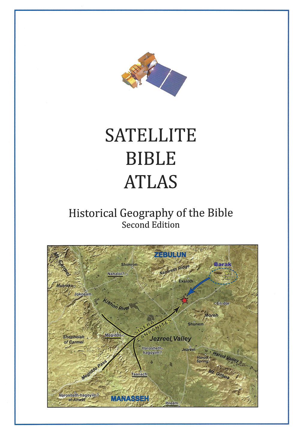
Links
Downloads
Dr. Cyndi Parker
Listen to the Land (Historical Geography)
BS600-09
Historical Background of Jerusalem
Lesson Transcript
[00:00:01] We're just traveling north and it's amazing how you don't have to get that much further. You're you're changing tribal allotments, tribal territory. I'm going to talk about in more big picture where Benjamin lived, because that's really important for us to know. But for the moment, I'm just going to focus on the city of Jerusalem. What is the geography of the city of Jerusalem like? And then we'll talk about how Jerusalem fits into the tribal allotment of Benjamin. I zoomed in on the map a little, so the map might start getting a little bit grainy. I want us to see not only that, Jerusalem is just north of Bethlehem, about five miles, but the texture around the city of Jerusalem. So look, first over to the left hand side of the picture, which is looking to the west of Jerusalem. And you may notice that the ground seems extra dramatic over there. It like it's rugged up here and it's rugged down here. But, boy, right here, this is called the Sort Wadi system. And it has just ripped apart the land in a very dramatic way. It looks almost like a crumpled up piece of paper that was just left crumpled. And so a very dramatic deep, deep V-shape valleys and steep hillsides. So this is called the Salk wadi system. It is just to the west of Jerusalem. And it actually provides a bit of a geographical barrier to Jerusalem, to the West, because even though in this picture we have roads heading out that way, there weren't actually that many roads leading out of Jerusalem heading directly west. The primary road is going to come north and west or go south closer to Bethlehem and head out and avoid this massive structure of the sort wadi system.
[00:02:24] Now, also Jerusalem. Let's look over to the east. Well, Jerusalem has the Mount of Olives so different than Bethlehem, where when we were looking at the area around Bethlehem, we could look one way and then look this way. And there's nothing breaking that landscape all the way to the wilderness. Not so with Jerusalem. With Jerusalem directly to the east. There's the spine of the Mount of Olives that kind of circles around the city. The Mount of Olives acts as a geological barrier between Jerusalem and the wilderness that is off to the eastern side. So when we think of Jerusalem, big picture, we see it has natural elements protecting it the Mount of Olives, the Sauk Wadi system to the West. This is wonderful. If you really want to protect the city, it acts as natural barriers. It's really quite a hassle if you're trying to get out of Jerusalem and get to any of the blue roads, any of the international roads. These become massive obstacles you have to get around somehow. Okay. So on top of that, I as I as I kind of zoomed in on the map, I just to be a little bit more specific. Jerusalem is not even on the main road. It's offset just a bit. It's not super dramatic, but it is offset. So again, interesting, it's not exactly on the road. So we have a massive barrier to the West, a massive barrier to the east. A little bit of a barrier here because we're not on the road. So. So Jerusalem's well protected, but it's also kind of well isolated when you're trying to get out. So we're going to keep our eye on that. So as I start to show you some pictures of Jerusalem and we're going to zoom in even more, keep in perspective that this yellow patriarchal highway that is going along the ridgeline is off to the west.
[00:04:31] Okay. So an actual picture. Here we go. I'm standing on the Mount of Olives, kind of on the northern part of the Mount of Olives. We're looking to the south and to the west, heading off that way. I drew in on top of this photo where the watershed would go or where the patriarchal highway is. And so if this is the ancient core of Jerusalem, you can see how it sits, actually quite a bit lower than where the ridge line is up here. And we're not on it. Now, there's a bit of an optical illusion going on with this picture because there's so many buildings that that we just look across and we lose the valleys and the hills. So we're going to we're going to pull in and look at those in a little bit more detail in a moment. But let's think for a moment if we're on the Mount of Olives thinking of the Mount of Olives as our nice geographical geological barrier. We're looking to the West. And if I were to ask you, just come up with a few adjectives of what you're seeing here. People often say things like, it's really green. There's a lot of trees, which is just evidence of having water. We have enough water to grow things and so it can be lush. We're at about 28 inches of rain, which is about the same amount of rain that London gets. It's just London gets it like spitting at you throughout the whole entire year. And Jerusalem gets it in massive downpours during the rainy season, but it's about the same amount of rain. So rain giving us greenery, which then gives us people. Now again, we're looking at the city of Jerusalem, modern day, which is one of the largest cities in Israel.
[00:06:15] So it looks extra populated. But it is showing us what would have been present in ancient times. So just to really understand the effects of the Mount of Olives, let's turn and walk. One eighth of a mile to instead of the western facing edge of the Mount of Olives. Just go to the eastern, facing edge of the Mount of Olives. And this is what you see. It's dramatic. It never ceases to impress people when I play this game with them because all of a sudden everything is different about our landscape. We have lost the greenery. Sure, we get a little bit of greenery here very close to us, but we lose it very quickly. When you get beyond that hill and that hill, it's gone. So we have cinnamon in that is exposed here, but Synanon everywhere else. We're looking towards the east. And if it were a clear day when I took this picture, you would see the ridgeline of the Transjordan again, still really high. We have obviously then less water and so there are fewer communities who are here. Now, there's a a large Arab neighborhood here. There's another neighborhood that is over here in modern day. There's a very large Jewish settlement way over on this hill. But they can exist over there only because they've piped in water. It's not because of the natural way the land works. So interesting, we can see dramatically how the Mount of Olives is protecting the city of Jerusalem, very different from five miles to the south with Bethlehem that doesn't have that kind of barrier between the wilderness. As we look at geography, think for a moment, I've been quoting a lot of Jeremiah, but we've also been hanging out in wilderness and dry landscapes.
[00:08:13] Jerusalem is here. Jeremiah is from Anatolia, which is up here. Notice how it's on the wilderness facing side of the mountain, which means Jeremiah's landscape more often than not is that. And when you read through the book of Jeremiah Jeremiah, one of his most favorite images to use are wilderness images. He's constantly pulling from what is a solitary tree that is out in the wilderness look like? What is God's presence when it shows up like a river to feed multiple trees? You know, all of these these great wilderness imagery, we can tell it has affected Jeremiah based on where he has grown up, which is wilderness facing. Interesting. I always tell people I'm like, before you do any of the prophetic books, before you study any of these prophets and their significant writings and what they mean, first find out where they're from and what their context is. It'll tell you a lot about their kind of imagery that they're using. Okay. Let's get even closer to Jerusalem. So we're going to zoom in. I have to change my maps here. So, again, just two places. The watershed is over here off it's off the map. The Mount of Olives is exactly where the picture ends. On this side, we can define the city of Jerusalem, ancient day, modern day by the hills and valleys that are around it. So I'm going to start with the valleys because I feel like those are the most definitive. They create the shapes for us. So the Kidron Valley is running along the eastern side of Jerusalem, right at the base of the Mount of Olives. And then we have I'm going to skip and go over to the west. This is the Hidden Valley. It is between the Kidron Valley and the Henham Valley that the city of Jerusalem throughout all of history until very modern day, expanded and contracted between those two valleys.
[00:10:25] It never went beyond them until modern day like 1900s or early 1900s. It was always just in-between the Kidron and the Henham. So what is interesting for historians and archeologists? Jerusalem is one of the most excavated cities in the world, is we're always trying to figure out the history, what we can find about history based on the archeology and what we dig up. And although we always know Kidron Valley, Hidden Valley, the question is always, well, how big was the city during this time period? This time period, who was a strong enough king to expand the city to fill up all of the land? Who were the weak kings where everyone scrunched in to the core in the heart of Jerusalem. Okay, so those are two very significant valleys to know which ones those are. And then we have what we're just going to call the Central Valley, because it's central. It actually has gone by several different names over time. Cheese makers, Valley, Tiruchi and Valley. Central Valley is just a lot easier to remember. And then there's a very, like itty bitty, really small valley. You can't see it in modern day, but you can feel it in your feet and in your quads. If you're paying attention, you know, you can feel the texture of the ground, but the optical illusion of all the modern buildings kind of wipes it out of you. And that is going to be the transversal valley. Transversal valley is our only valley in this area that is really going east and west. So it's quite shallow and it's going to join this central valley with the Henham Valley over here. Okay. So we have our valleys down, which means these valleys are going to define hills for us to hills in particular that we're interested in.
[00:12:20] All of these are going to fit in between the valleys. We have the eastern hill. And if we were to describe the eastern hill, I mean, ever since I learned geography the very first time, we have always said the eastern hill is very narrow and very low in elevation. This sits right at as one of the lowest hills in this surrounding area that creates almost a bowl around Jerusalem. The eastern hill is quite low and obviously it's quite narrow and it fits just really snug in between the Central Valley and the Kidron Valley. In opposition to that, between the Central Valley and the Henan Valley is the Western Hill and it is the exact opposite of the eastern hill. It is quite wide and it is very high in elevation. So Eastern Valley is low and narrow. Western or western hill is high and wide. Now, if I were to say just based on that, just based on the geography, what is the most strategic place of the city? What do you think is the most ancient core of the city? Almost always people say, Well, we want to live on the western hill. There's the most space up here and it's higher and higher. Elevated hill is always easier to protect, and in a way that seems not very intuitive, it is the eastern hill that is the ancient core of the city, which always begs the question why? Why do people settle there when they had the Western Hill at their disposal? The question comes down to the very basics of human life. What do you need to survive you're most like? Your first thing you have to think about is water. You will never exist without water. There is one spring in this entire area and it is here in the Kidron Valley, right on the side of the eastern hill.
[00:14:19] So why do people settle here? Their water was here, so they're like, We're just going to make do with what we have because our most precious commodity is going to be here. Now, if this is the ancient core, even more so are we removed from the patriarchal highway or this watershed? Because you have to get beyond the western hill. Now, this also means that if you're standing exactly opposite the city and if the western hill is high, you can look at the western hill, but you can't see beyond it to the eastern hill. You might be able to see over the top of it to the Mount of Olives. So the eastern hill is quite out of sight, almost out of view. Now, if you're quite far to the south, if you're south of the valley, the hidden valley, you can kind of look and an angle this way and you can see the ancient core of Jerusalem. It's just interesting to kind of note that now it shows up in some of our stories. So if we think about Israelite history and the Israelites coming into the land, when Joshua comes in with the people, there is an initial battle that is instigated by the king of Jerusalem. And we're going to tell that battle actually in greater detail in a moment. Joshua comes in, the king of Jerusalem, instigates this battle and loses, and the king of Jerusalem is killed. But Joshua does not take the city of Jerusalem, so he takes out the leadership. But the sites continue to live there. The websites lived there throughout all the time. That's always king. And we see in evidence the sites being here in this ancient part of the city, even during the time of the Judges.
[00:15:59] So I'm going to read it's another one of those very troublesome portions of scripture that we kind of wrestle with how to deal with the interpretive part. But it just makes the geographic the geographic part is really easy. So I'm just going to stop with the geography. So Judges 19, we have a Levite whose concubine left and went back home to Bethlehem. So we can see that on our mental map where Bethlehem is, it is just south of Jerusalem. The Levite goes and goes to Bethlehem and ends up staying there for three days. And then finally he's like, Look, we really have to go. But it speaks of the hospitality. I love it. The concubines, dad is like, no, to stay one more day. And he's like, okay, you know? And then the next day I got to go now to stay one more days, like, okay, you know, it seems to reflect how people act to this day, but finally they get up and they leave and they're traveling north along the patriarchal highway, and dusk is coming, which is a dangerous time to be out. You need to start to find shelter. So it's towards the end of the day. And it says in Judges 19, when they were near J. Bus, which is this eastern hill of Jerusalem. So the sites living here, so they were near Jews. The day was almost gone. And then there's a little drama that happens. And then, however, his mastered the servant is saying, Let's just go there. Like we're almost there. We're opposite the city. And we can see we can hear the geography and the response of the Levite. He says. We will not turn aside into the city, right, which only if you're removed from the city do you turn aside to go into the city.
[00:17:46] But instead we will go on. As far as Jibia Jibia of course, later on is going to be the hometown of Saul. So Jibia was of the tribal allotment of Benjamin. And so he looks at this and is like, okay, the sites live over there almost out of sight. Like it's it's going to be inconvenient for us to go over there. Let's just keep heading north to our own people, which of course, if we continue reading, Judges becomes complicated that story. But we'll leave that there from now. If we were to look at the city of Jerusalem and I was really happy to get this picture, it's just the right time of day where the shadows illuminate the valleys. So everything that is on this picture is the eastern hill. So if you see the shadow over here, this is of the Kidron Valley. And so we can see the slope up to the eastern hill here. And then we're actually getting the shadows cast over the homes, although it again seems flat, it seems all continuous these days. The Central Valley has almost completely disappeared. But you can still you can kind of pick out with the shadow where the Central Valley would have been. So this is showing us that oblong shape of the eastern hill, the highest, most elevated point, of course, being where the current Dome of the Rock is, where the Temple Solomon's Temple would have stood, although that wouldn't have been built up during the Jews. The site time nor during the time of David, it would have only been this oblong. And again, we can see how it's quite narrow and it's low in elevation because everything around it is significantly higher. Which then when we read through the songs of Ascent, which are great to do with a map of Jerusalem or with your own feet in Jerusalem, these songs were sung historically with or by pilgrims who were making their way up to Jerusalem.
[00:19:53] And we can hear these very specific, real connections to the landscape that create these theological messages. But even like Psalm 122 that says Jerusalem, that is built as a city that is compact together. Like, okay, so yes, we're looking at modern Jerusalem. And so it's even more built up. But given the limited amount of space that you would have had available to you on the Eastern Hill, it would have had to be very compact and built very close together. Okay. So let's zoom out and get a little bit of a wider picture of Jerusalem where, again, you can see this is the Kidron Valley. This is the Central Valley. We can see the rise up to the western hill, even though we can't see the end of the western hill. But at least we can see again the comparisons. And since we're taking a little bit of a step back, we can again just see how all the mountains that surround Jerusalem are just so much higher. This has to impact the way people formulated their view of others. Think of yourself growing up in Jerusalem. Your horizon line is tight. It doesn't go very far. We're looking at just a couple miles wide. And so if if you can't quite see what is coming your way, you're you're always just a bit suspicious of what is about to come up over the mountain. You may not be in immediate danger, but you're going to be suspicious. Any of the people you can't see are those people that them you know, the ones that are so easy to assign characteristics to people who are out of sight. We tend to find, even though this would have been an urban environment, Jerusalem, we also see that it's in a very conservative area.
[00:21:52] The geography induces this kind of conservative ness in the people who live there. Contrast this with memories of the pictures I showed when we were down on the Philistine Coastal Plain. How wide open that landscape is right in the wide open, and they're right on the international road. And there's an exchange of ideas and exchange of goods going on on a regular basis, but not up here in Jerusalem. We have to keep this in mind because it is going to challenge or it's going to influence the way the people in Jerusalem are. And that is throughout time. Even Old and New Testaments and then beyond. So in a moment, we're going to move into what New Testament Jerusalem would have looked like and who Jesus interacted with here in New Testament Jerusalem. And we're going to just we're going to keep it in mind, because when we get to Galilee, we're going to contrast. What does this landscape do to your view of others versus Galilee up north? What does that landscape do to your view of others? So we're going to keep this in mind, but we're noticing the high hills that go all the way around the city of Jerusalem. I'm going I'm going to change my perspective a little bit. This is standing on the southern steps that lead up to the Temple Mount. So we're archeologically on a New Testament site, but we're looking down on to you. If we're on the highest point of the eastern hill, the eastern hill is going down from here. So again, we're just catching our view of how the mountains surround Jerusalem, which, of course, another song of ascent makes use of this idea. I will lift up my eyes to the mountains from where shall my help come? And there's this the mountains that surround Jerusalem, you know, and the psalmist used that imagery all the time.
[00:23:52] Let's go back to David. We were looking at David when he was king for seven years in Hebron. But we know David moved his his kingdom and he anchors it. The Capital C anchors it into Jerusalem. Why does he do that? The Hidden Valley is the dividing line between the tribe of Benjamin to the north and the tribe of Judah to the south. So the Hidden Valley is very significant for defining Jerusalem. This is the Jabu site city. So let's put this a little bit into perspective. David comes from this tribe. Judah, the king the Israelites just had. Saul was from this tribe. Benjamin. Benjamin put up a huge stink when David claimed kingship because they wanted a descendant of Saul to be king. So there is a we wish we could have, you know, and it takes seven years to figure that stuff out. So it could to a certain extent, there could be something really wonderful about David doing a head nod and saying, okay, I'm from Judah, but I'll put my capital city in your territory. That would be very generous of him. There's also like a little hidden punch in there as well, because this is Saul's territory. He's of the tribe of Benjamin and Saul as king. Never got rid of the sites. He could never take the city and the Jabu sites persisted in that land. So in David goes and is able to take the Jabu site city. There is a little bit of one upping Saul and then also going, okay and Benjamin will put the capital city in your area. And it's it's a city. It's not quite as amazing as Hebron is with all those roads going up to it and a high plateau and all that.
[00:25:50] Agriculture. Jerusalem is a little bit you know, it's protected and yet it's isolated. It's a little bit trickier. But it is also just a little bit more central, giving a little bit more access to all the tribes instead of all the way down south along the whole country. So maybe that also plays into it. So using this kind of we're going to I'm going to create I'm going to bring your attention to a few things is what I'm going to do because I want to build layers of stories. And some of these are not necessarily stories that, again, we've connected to the ground, so we don't pay so much attention to. The first one is going to take place at the very end of David's reign. So David becomes an old man and his sons actually start fighting over who's going to end up inheriting Dad's kingdom, you know. And at one point in time, Absalom, one of David's favorite sons, oldest sons, says, well, I'm just going to I'm just going to take it. Dad doesn't seem to be doing anything. And so Absalom puts himself in a position where he's earning the trust of all the heads of all of the tribes. And David knows this. And at some point people come to David and say, you know, Absalom is just about ready to take over your kingdom. You need to do something. And David, at the end of his life is like, I have to flee. Like I. I probably don't have enough people loyal to me right now to be able to defend myself against Absalom, who has set himself up as this great kind of inheritor of the throne. So David flees Jerusalem when he does listen to this geography.
[00:27:34] David went up the ascent of the Mount of Olives, weeping as he went barefoot and with his head covered. And all the people who were with him covered their heads and they wept up, weeping as they went. There's the weeping of leaving the city that has the tabernacle there has God's presence there. This city of David, as the city of Jerusalem came to be called, and he's fleeing and we can see him fleeing to the east. So he goes up the Mount of Olives and into the wilderness where it's really quite easy to go and disappear. And ultimately, David And you can feel that like the tragic ness of his loss and as he weeps, as he comes this way down through the wilderness and he goes over to the Transjordan, which is where he's going to find refuge until the problem with Absalom can be solved. This is when Absalom the fighting continues all the way to the north, and Absalom ends up dying because he has amazing, luscious hair, gets stuck in a tree and all that drama, which is great fun. And then we watch David and in an opposite way of emotion, there's great rejoicing as he comes up over the wilderness, through the wilderness, over the Mount of Olives and back down into the city. And people rejoice. The kingdom has been restored to David until David later passes this on to Solomon. Now, this movement is really quite interesting and I want to pull your attention to at the other end of Hebrew scripture in Ezekiel. So a prophet Ezekiel is not prophesying from within the city of Jerusalem. He is already been taken away into Babylon, but he is writing letters and is prophesying, having visions. And a lot of the visions have to do with what's going on in Jerusalem and with the temple and with God's presence among his people.
[00:29:29] And there's a whole bunch of destruction that is happening at the beginning of the Book of Ezekiel and a whole lot of rebuilding that is happening at the back half of the Book of Ezekiel. So let's pay attention. We're in the first part of Ezekiel and just look at the movement, trace it on the map. So by now we have already expanded the Eastern held to go all the way north. Solomon has built the temple up here on the highest part of the eastern hill. The temple is rectangular in shape and it faces the east. So you enter the temple from the east, and as you pass through the temple you go to smaller and smaller and smaller sections of the temple. Right. So that's going to be right up here. So with that in mind, look at the movement and we're missing a whole bunch of amazing and super confusing prophecy as as we go, because I want to focus on the geography. So in Ezekiel nine and then scattered throughout that chapter, it says, then the glory of the God of Israel went up from the cherub on which it had been. So we're in the holy of holies in the temple. And O to the threshold of the temple. So the Spirit of God is moving from the Holy of Holies to the threshold of the temple. What direction is it moving? East because it's moving from back here and it's going to the threshold of the temple here. The glory of the Lord departed from the threshold of the temple and stood over the cherubim, and they stood still at the entrance of the east gate of the Lord's house. So now we've left the temple and we're going to the east gate.
[00:31:22] Then the glory of the Lord went up from the midst of the city and stood over the mountain, which is east of the city. Which mountain is east of the city? It's the Mount of Olives. So we're looking at similar to I'm going to say, just so that you keep in mind the movement of David out of the city. We had the movement of the spirit of God out of the city. Some people will say the spirit of God is going out of the city in order to go into exile with his people. Maybe it's a it's an interesting theological interpretation. Now. Then this is where we get the destruction of the city and the destruction of the temple. But Ezekiel isn't going to leave us there. Ezekiel is going to go like a lot of the latter prophets do. All this destruction and warning karma. But restoration and Ezekiel spends a lot of time on what that restoration is going to look like. And part of the restoration is the glory of the God of Israel was coming from the way of the east. We're like, Oh, God is returning to his city. And the glory of the Lord came into the house, by the way, of the gate facing towards the east. So there's a retracing of the steps and a rejoicing in the return of the Spirit of God back into the house among his people. Now. It doesn't stop there. But this is another one of those a little too long to actually quote and put on the screen. So turn with me to Ezekiel 47. And again, we just have to know the geography of Jerusalem for this to be so stinking cool. So in Ezekiel 47, because the Spirit of God has gone and has sat on the in the Holy of Holies once more we get this imagery of water, living water that starts pouring out from the throne room and is leading and is going pouring out of the temple into the city.
[00:33:30] Well, that's kind of interesting, right? Because if the temple is here and if water is pouring out, it's pouring into which valley? The Kidron Valley. So when we were reading Ezekiel 47 there, the host is taking Ezekiel and going, Do you see this water? Let's follow where the water goes. And they keep going a little bit further and then they go a little bit further and the water water's getting deeper. Let's talk a little bit further and the water is getting even deeper. And so I'm going to pick up this story with verse six. He said to me, Son of man, have you seen this? Then he brought me back to the bank of the river. Now, when I had returned, behold, on the bank of the river, there were very many trees on one side and the other. Of course, we've already seen the effects of living water. Then he said to me, these waters go out to towards the eastern region. Towards the east. What's east of us? Wilderness. Rift Valley. Dead Sea. So this water is flowing all the way out to the east. Yep. Verse eight Then he said to me, These waters go out towards the eastern region and go down into the river. Right now, we know are advised the Rift Valley. And they go towards the sea. Which sea? The Dead Sea made to flow into the sea. And the waters of the sea become fresh. Oh, talk about the power of that kind of living water that can go down into the Dead Sea and heal or turn fresh. Even the Dead Sea. It will come about that every living creature which swarms in every place where the river goes will live and there will be very many fish for these waters.
[00:35:30] Go there and the others become fresh. So everything will live where the river goes and then it continues. There will be so many fishermen, there will be a fighting fish. But this is one of those passages where I'm like, Oh, as soon as you put it on to the map, you're like, That is so beautiful because you've now seen you have been thirsty with me in the wilderness. And the imagery of that kind of living, water flowing and healing, that kind of land is is beautiful. Okay. We have a few more stories before I get to first century Jerusalem. And this one I like to say just for fun, because people don't always understand this connection and I have a very personal connection to it. And so I love it. The Hidden Valley is what we're focusing on. So this is the the snake of the Hidden Valley is here the way it bends around the city and defines the city in Hebrew. This is guy Ben Hannam. It's the way it is translated. So the valley or a sharp V-shaped valley, the valley of the Suns of him now, whose name we don't know, but he gave us the name of the valley. And so Guy Ben Hannum, is this actual like physical cut in the ground? Well, when we look at Hebrew scripture that is then being translated into Greek and we start to pull in Greek in the New Testament, even this guy, Ben Hannam, becomes Gihanna. Gaynor in English Bibles is translated as hell. But it's making reference to a real place that people would have known of. So what else do we know about the value of Guy Ben Hannum? And how on earth does it start to take on connotations associated with hell? Well, we can read Second Kings 23, second Chronicles 28, second Chronicles 33.
[00:37:31] And what we're seeing is at different points in time in Israelite history, when they were worshiping other gods and building temples to other gods. The Valley of Benin Nome is where they went to offer child sacrifice. So this becomes like the epitome of the opposite way to living covenant with God as God's house that is up here on the Eastern Hill. It is lower geographically, but it's lower morally as well. And so there is something about the memory, again, because geography holds on to memories and holds on to events. When people made reference to Guy Ben Hannan, people are like, okay, yes. It's not just an obscure place that helps define Jerusalem. It is a place that holds on to memory of when we were very far away from our covenant with God. And that becomes the visual element that in the Gospels there's continual reference to Gihanna remember gihanna and the types of things that happened in Gihanna the fires of Gihanna. It should make everyone shudder because it's the memory you don't want to remember, but it's important for you to remember. So Valley of Hingham is home. Now what's really fun is hell still exist today. When you go visit the city of Jerusalem, it is still there. I used to work right here and I used to live over here. And so I'd have to walk down into the valley and come up the valley. So I always came back from Jerusalem telling my dad I also walked uphill both ways. You know, sometimes in the snow and hell does freeze over just about every year. So it's kind of it's it's again, just another one of those where the geography is adding additional layers onto what we're thinking. Let's pause for a second.
[00:39:27] We're going to move into first century Jerusalem. But I want to give us a chance, as we've been sitting for a while, to just kind of stand up and stretch her legs, and then we're going to come back and look at Jerusalem. So before I do any quick questions or comments from anyone, Jerusalem, the reason that David determined that as a capital is because it was a political thing between the two tribes. Since then, it seems like Jerusalem has taken on a central place in prophecy and a central place in the world with the mosque and and all those things. But the city itself, I mean, it's easily protected, but it's not convenient. Nope. And it seems like there's a lot of elevation difference within the city, which would make it challenging to live and to build and to to travel back and forth between neighborhoods. Yeah, it seems prominent, but it seems like there's a lot of things about it that are really inconvenient. It is true. It is true. Yep. And all you need is one day walking around the city to. To feel like you've done a stair climber all day long. Yeah, there's a lot of places it would have been way more. Yes, it's easier. Yes. To do it in Jerusalem is the place where. Yeah. All this stuff landed. Yeah. And and there's a lot of interesting things behind that. Behind you noticing that, I think. Well, one, it kind of speaks to the early days of the Israelites when they weren't strong enough to get out of the hill country, when maybe having protection was a little bit more valuable to them. So to a certain extent, we're going, Oh, yeah, okay, I see that. And we're also seeing because you said there's so much emphasis on it, but we're seeing it's the temple, it's God's house in and among his people that elevates this city into this grand doneness.
[00:41:23] And so even one of the Psalms. By. I forget exactly offhand. So I'm not going to say it because then I'll be wrong. I'll choose the wrong one. But all the time there's this comparison between, oh, there's like grandiose, like, oh, how awesome, how elevated, how beautiful is your mountain? Oh, God. And it's it's easy for us to picture something as grandiose as the Alps and think, Oh, it must be amazing. And then you see it in reality, you're like, It's kind of not all that impressive, but the scientist will say, like, you were hill where you are, where your presence is the most beautiful among all of the mountain, even more beautiful than Mount Hermon, which is the highest mount is gorgeous and amazing. But what we're seeing is they're kind of making a comparison geographically between something that is actually kind of small and something truly grandiose.